Why is I-85 the riskiest road in the US? 10 roads to be vigilant around!
 Landmarks
Mind the curves
Why is I-85 the riskiest road in the US? 10 roads to be vigilant around!
You’ve probably driven these roads dozens of times. They don’t look dangerous. There are no cliffs or warning signs. Yet year after year, these highways see far more deadly crashes than most others in the country, not because of bad luck, but because of patterns most drivers never consider. If you travel by car, this is information worth knowing before your next trip.
Interstate 35 (Texas to Minnesota)
Interstate 35 runs straight through the middle of the country, and this geographic variety is part of the problem. The long rural sections in the Plains invite fatigue and speeding, while Texas cities bring traffic jams and heavy truck flow. Most crashes are caused by human error rather than weather conditions. This road requires drivers to stay alert across very different driving environments.
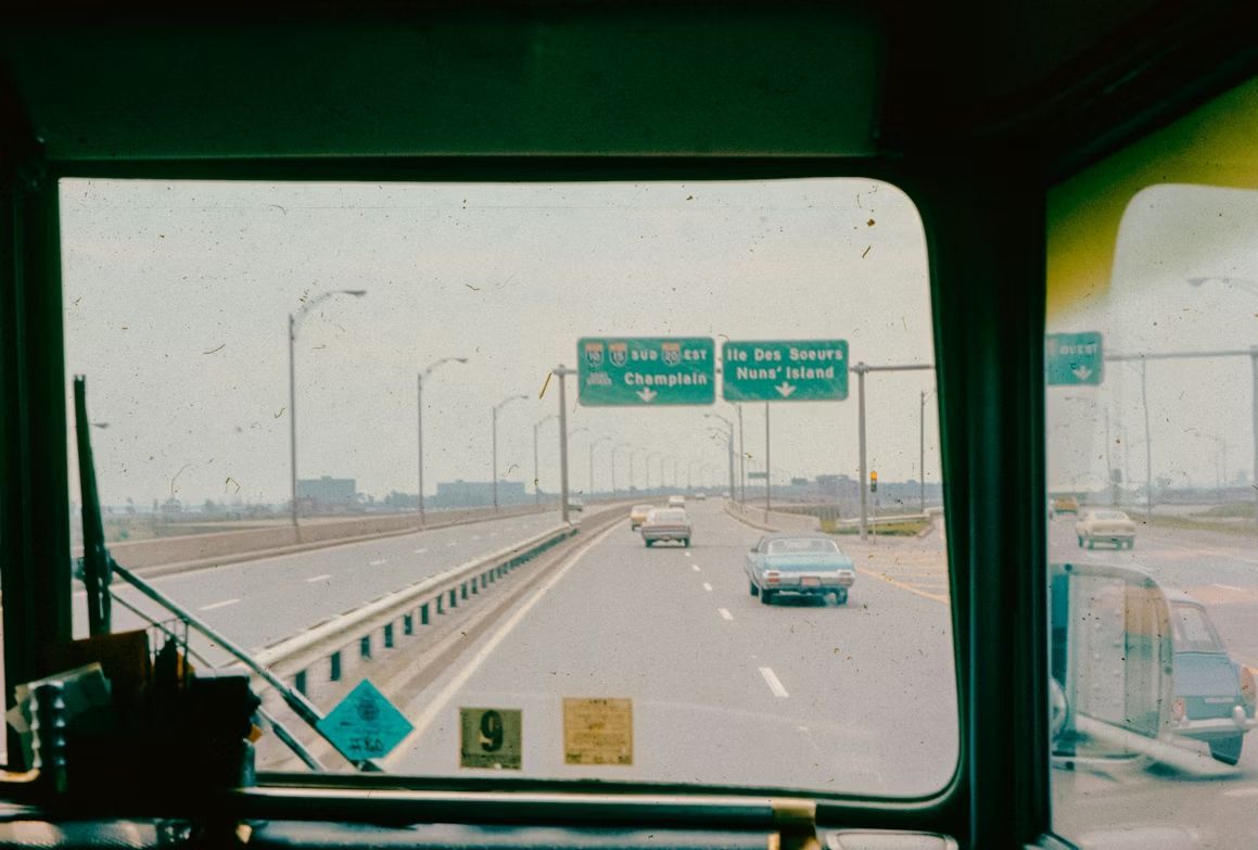
Interstate 95 (Florida to Maine)
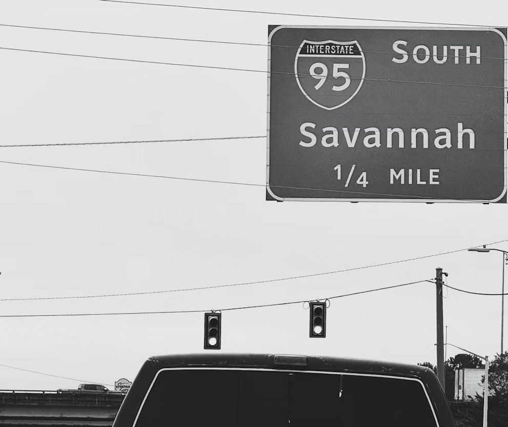
Interstate 95 never seems to slow down. From Miami to Boston, traffic density remains consistently high. Urban areas see frequent multi-car crashes, while rural stretches are more prone to fatigue-related accidents. Add in rainstorms, winter ice, and increased weekend alcohol use, and you get a highway that demands a vigilant eye at all times.
Interstate 4 (Florida)
This one may be short, but it’s crowded and unforgiving all the same. Interstate 4 is often cited as one of the most dangerous highways on a per-mile basis. Linking Tampa, Orlando, and Daytona Beach, it’s rarely quiet. Theme park traffic, frequent lane changes, distracted driving, and sudden Florida downpours combine into a perfect storm. It’s intense driving from start to finish.
US Route 101 (California to Washington)
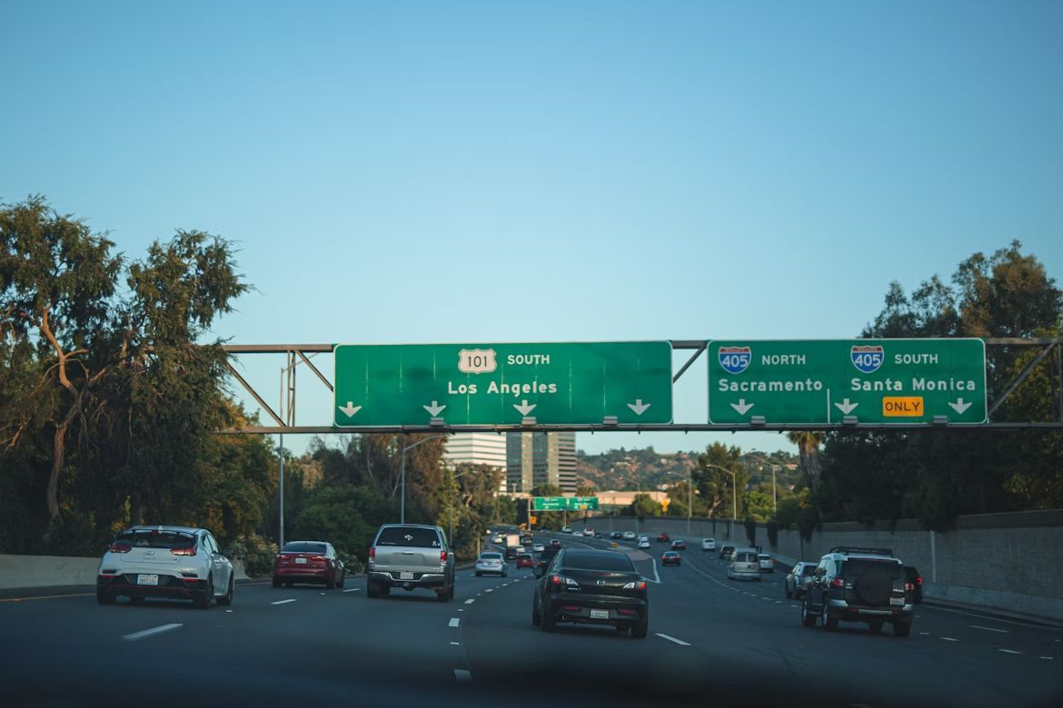
US Route 101 is a road of mixed personalities. In cities like Los Angeles and San Francisco, congestion leads to minor collisions and larger multi-vehicle pileups. Farther north, it narrows into winding, scenic stretches near cliffs and forests. Night driving and sharp curves contribute to a high number of single-vehicle crashes. The view? Yes, it’s beautiful, but it demands attention.
Interstate 10 (California to Florida)
Interstate 10 stretches coast to coast, and its sheer length works against it. Long desert sections also encourage speeding and driver fatigue, while cities like Houston and Phoenix deliver traffic jams and pileups. Weather is rarely a factor, so safe driving depends almost entirely on driver choices.
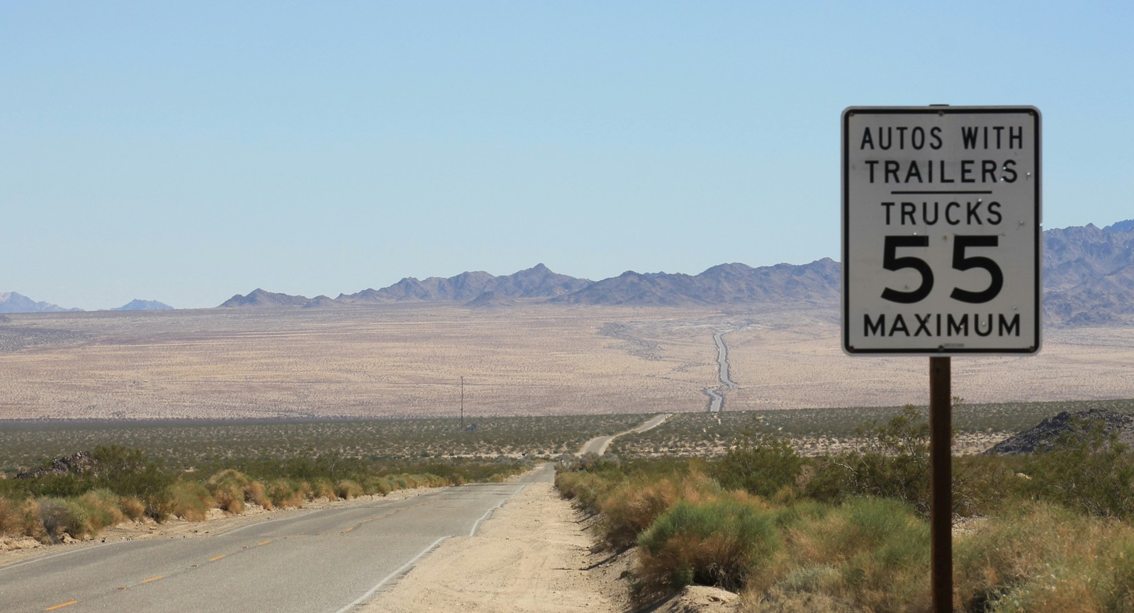
Interstate 55 (Louisiana to Illinois)
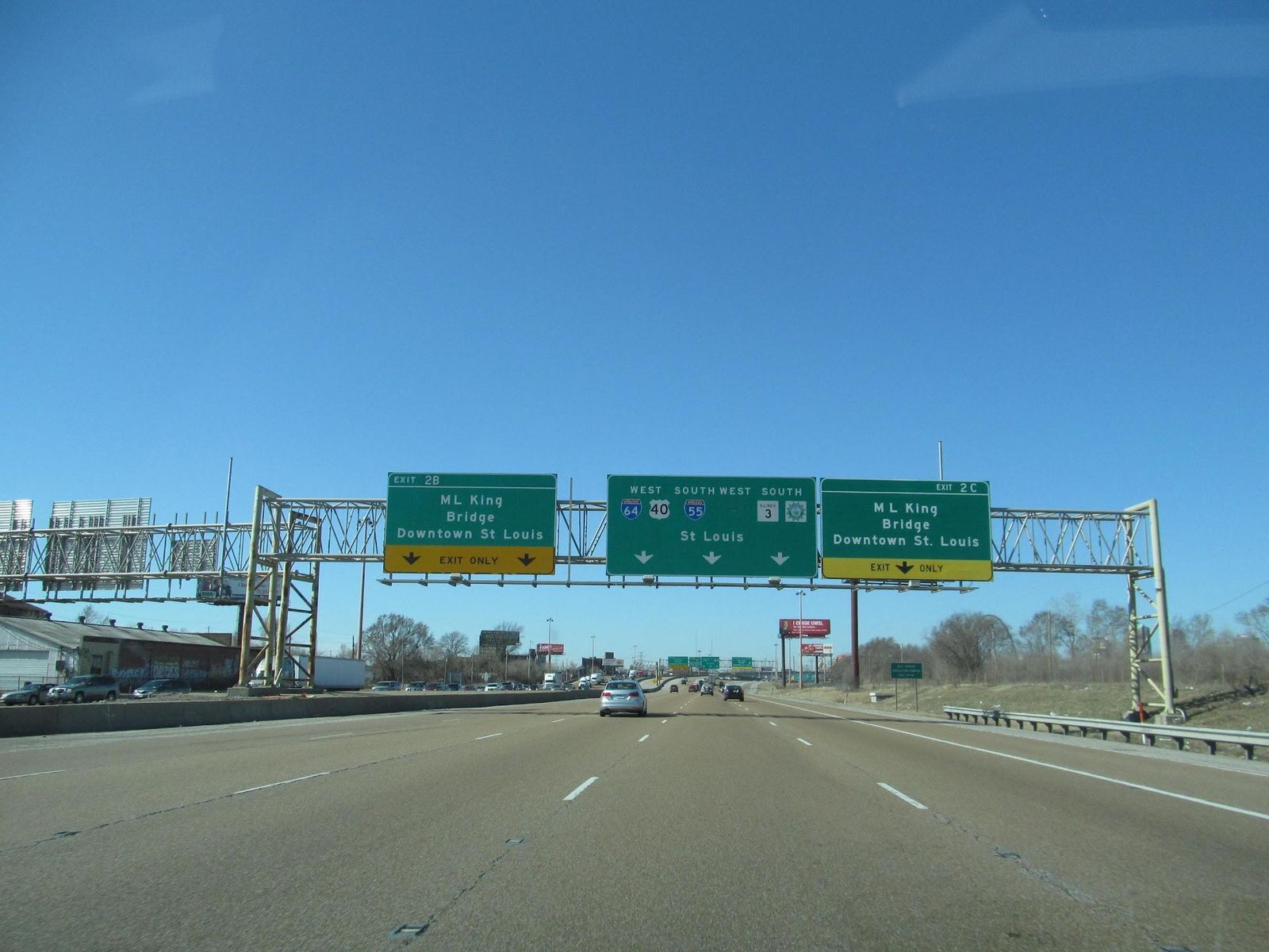
Stretching from Chicago to New Orleans, Interstate 55 deals with almost every challenge imaginable. Northern sections face snow and ice, while southern stretches see nighttime rural crashes often involving alcohol. Heavy truck traffic runs the length of the road, increasing both the frequency and severity of accidents. It’s a corridor that rarely gives drivers a break.
Interstate 65 (Alabama to Indiana)
Interstate 65 may be shorter than some cross-country roads, but its crash rate is impressively high. Urban congestion in the Midwestern US blends into long rural stretches farther south, where higher speeds are rather common. Truckers, commuters, and local drivers all share the road, often with very different expectations.
Interstate 5 (Mexico to Canada)
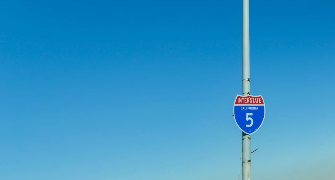
Interstate 5 is the backbone of the West Coast, carrying everything from daily commuters to cross-country freight. Rural areas see speed-related runoffs, while cities like Los Angeles and Seattle bring congestion and collisions. Long gaps between services and driver fatigue only add to the challenge on this essential but demanding route.
Interstate 75 (Florida to Michigan)
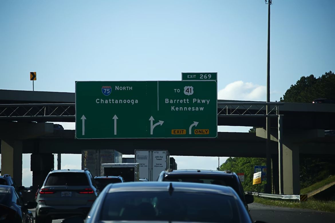
Running from Michigan to Florida, Interstate 75 carries vacationers, trucks, and daily commuters all at once. Urban congestion around major cities blends with nighttime rural crashes in the South. Seatbelt use drops in some regions, and alcohol-related incidents increase on weekends. It’s busy almost everywhere, almost all the time.
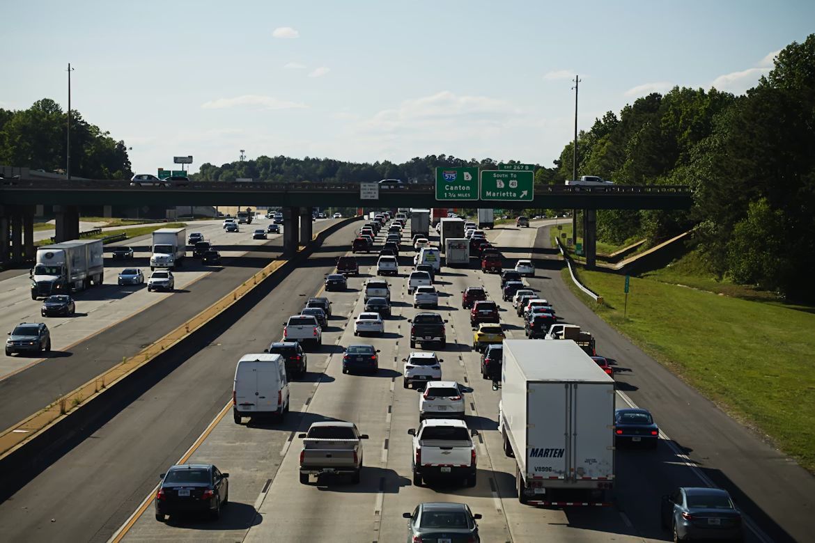
Interstate 85 (Alabama to Virginia)
Interstate 85 may not be long, but it is just as dangerous as the longest roads. Urban areas like Atlanta and Charlotte generate congestion-related crashes, while rural sections see more speeding and exhausted drivers take over. And this one is no exception; alcohol does show up often in weekend incidents. Per mile, it’s among the riskiest highways due to a combination of urban congestion and rural speeding.
These deadly spots might be fascinating, but maybe not worth the visit?
 Geography
Who would dare?
Stay away from these: A peek into some of the world's deadliest corners
Some places on Earth are dangerous because they are extreme. Others are dangerous because they look harmless. Let’s take a look at locations where nature, geography, or isolation have earned a reputation for being… unforgiving. Burning craters, frozen villages, poisonous volcanoes: beautiful, maybe, but arguably not worth the visit.
A cliff-hugging mountain route with no guardrails
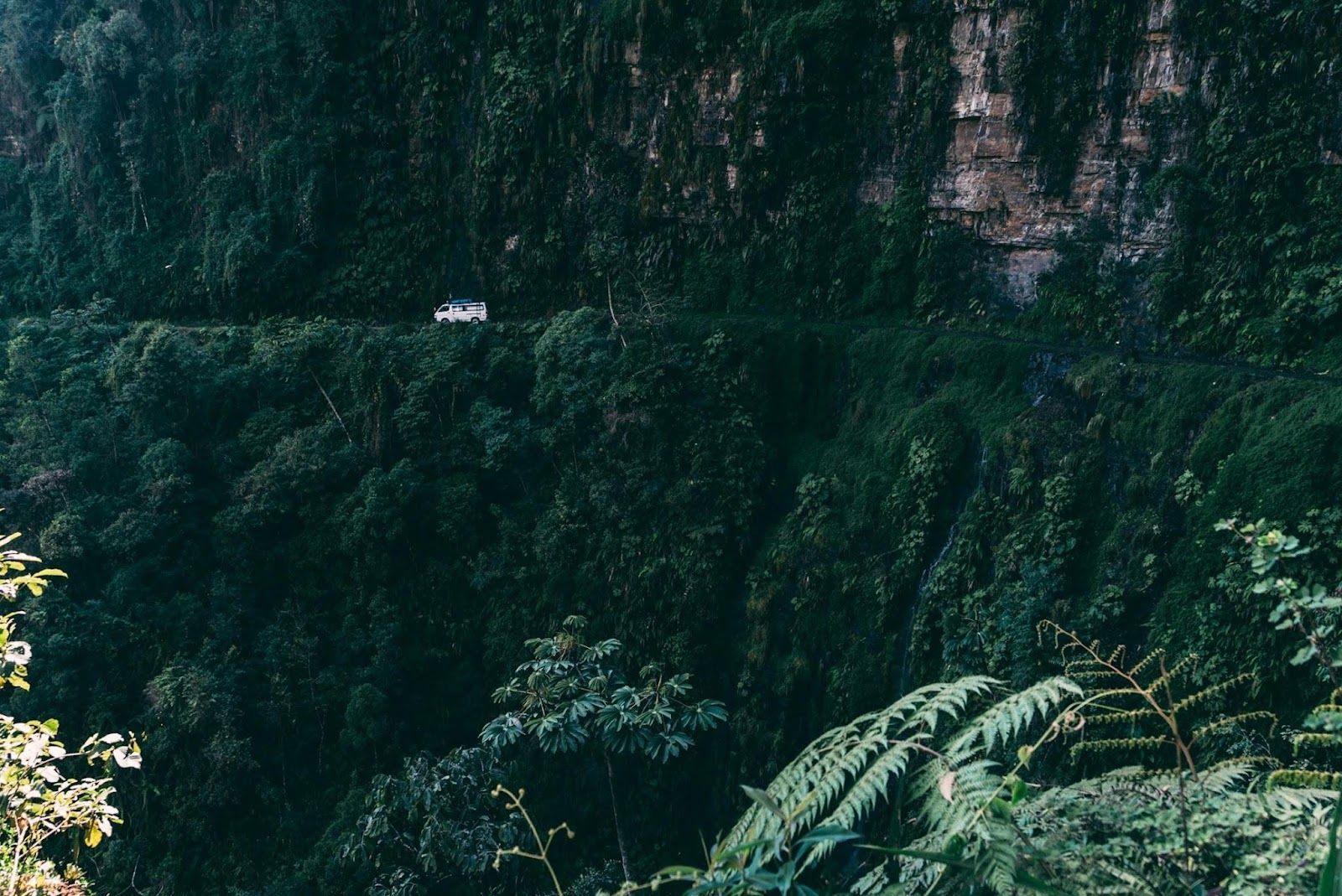 Image: Kyle Loftus
That’s exactly as narrow as it looks. Hidden deep in Bolivia’s Andes, this road was once considered the most dangerous drive on Earth. In some sections, it shrinks to a single lane, with sheer drops plunging thousands of feet into the jungle below.
That’s why it earned the nickname "Death Road." Only for the experienced–and brave–drivers!
A burning crater that has been on fire for decades
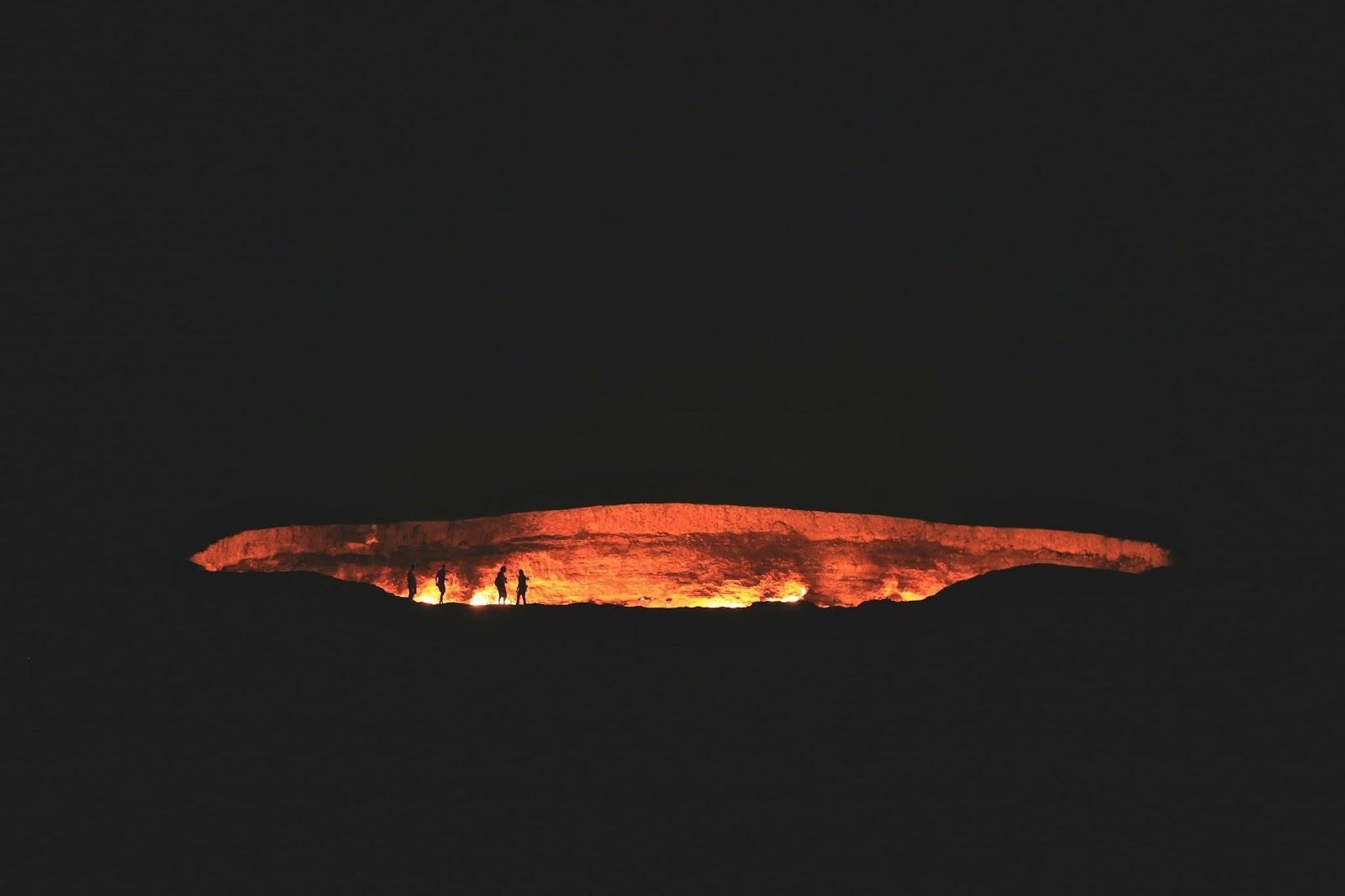 Image: Ybrayym Esenov
Did you know there’s a massive crater in a desert that has been burning continuously since the 1970s? No wonder people call it the "Door to Hell."
It’s in the middle of Turkmenistan’s Karakum Desert, and it was accidentally ignited during a Soviet drilling operation that struck a natural gas pocket. Engineers set it on fire, expecting it to burn out in days… but it never did.
An island where venomous snakes outnumber humans
 Image: Harshit Suryawanshi
In Brazil, civilians are forbidden from visiting Snake Island. Located off the country’s coast, it is home to thousands of golden lancehead vipers, one of the most venomous snakes in the world.
Only scientists are permitted to go there, and for good reason: a single bite can be fatal without immediate medical care.
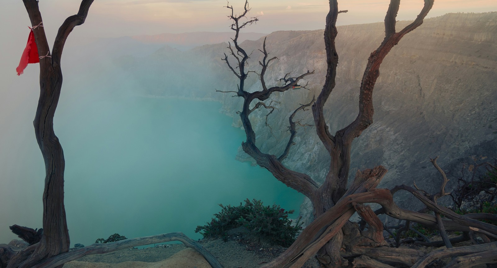
A volcano where toxic gas surrounds sulfur miners
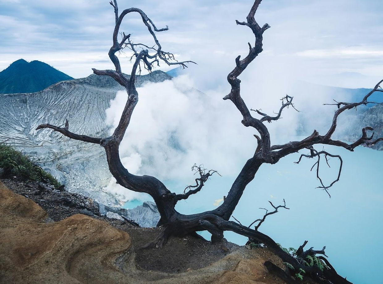 Image: Spenser Sembrat
Stay away from the interior of Indonesia’s Kawah Ijen volcano, too. The crater emits thick clouds of sulfur gas that can burn lungs and eyes within minutes. The volcano is also famous for its "blue fire," an electric-looking glow caused by ignited sulfur gases at night.
A peaceful-looking lake that released a deadly cloud
 Image: Edouard TAMBA
Lake Nyos in Cameroon appears calm and ordinary, but in 1986, it became the site of one of the strangest natural disasters ever recorded. Without warning, the lake released a massive cloud of carbon dioxide that rolled silently through nearby villages.
The gas displaced oxygen in the air, suffocating more than 1,700 people and countless animals as they slept.
Temperatures to freeze engines
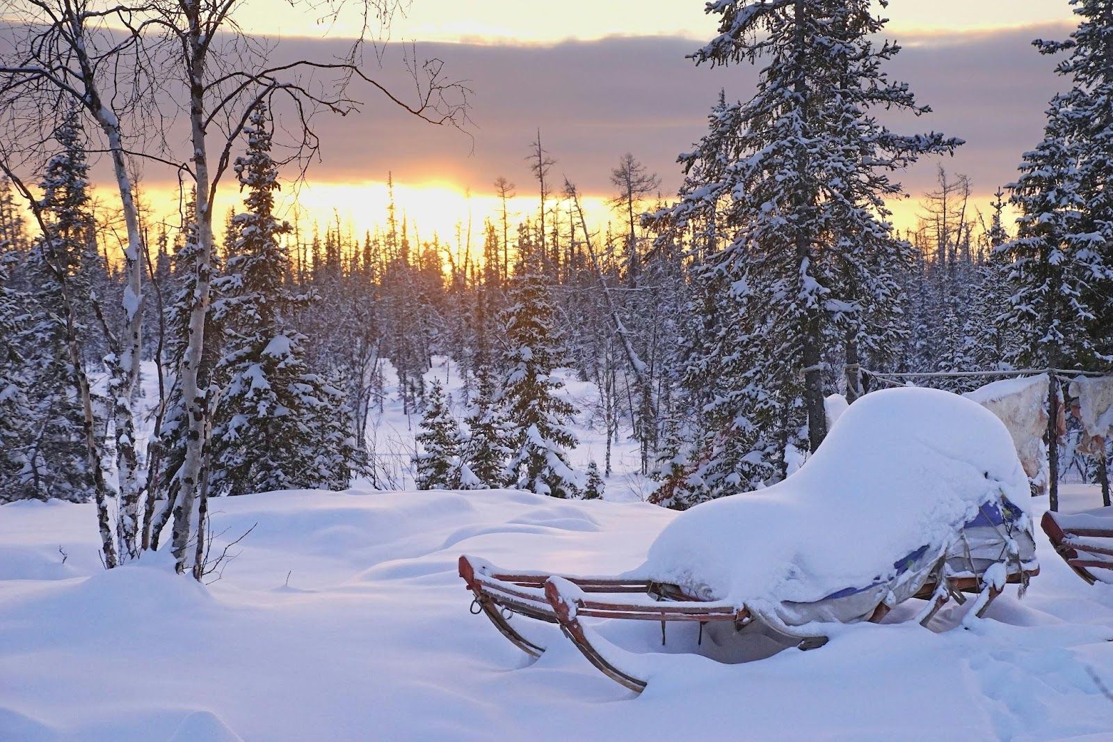 Image: Hans-Jurgen Mager
Oymyakon, in eastern Siberia, is one of the coldest permanently inhabited places on the planet. Winter temperatures routinely drop below –50°F, cold enough to freeze exposed skin in minutes and cause cars to stall if left running outside for too long.
Everyday tasks, from going outside to cooking meals, require constant adaptation to the cold. Schools only close when temperatures become truly extreme, which says a lot about daily life in the village.
One of the hottest and most toxic places on the planet
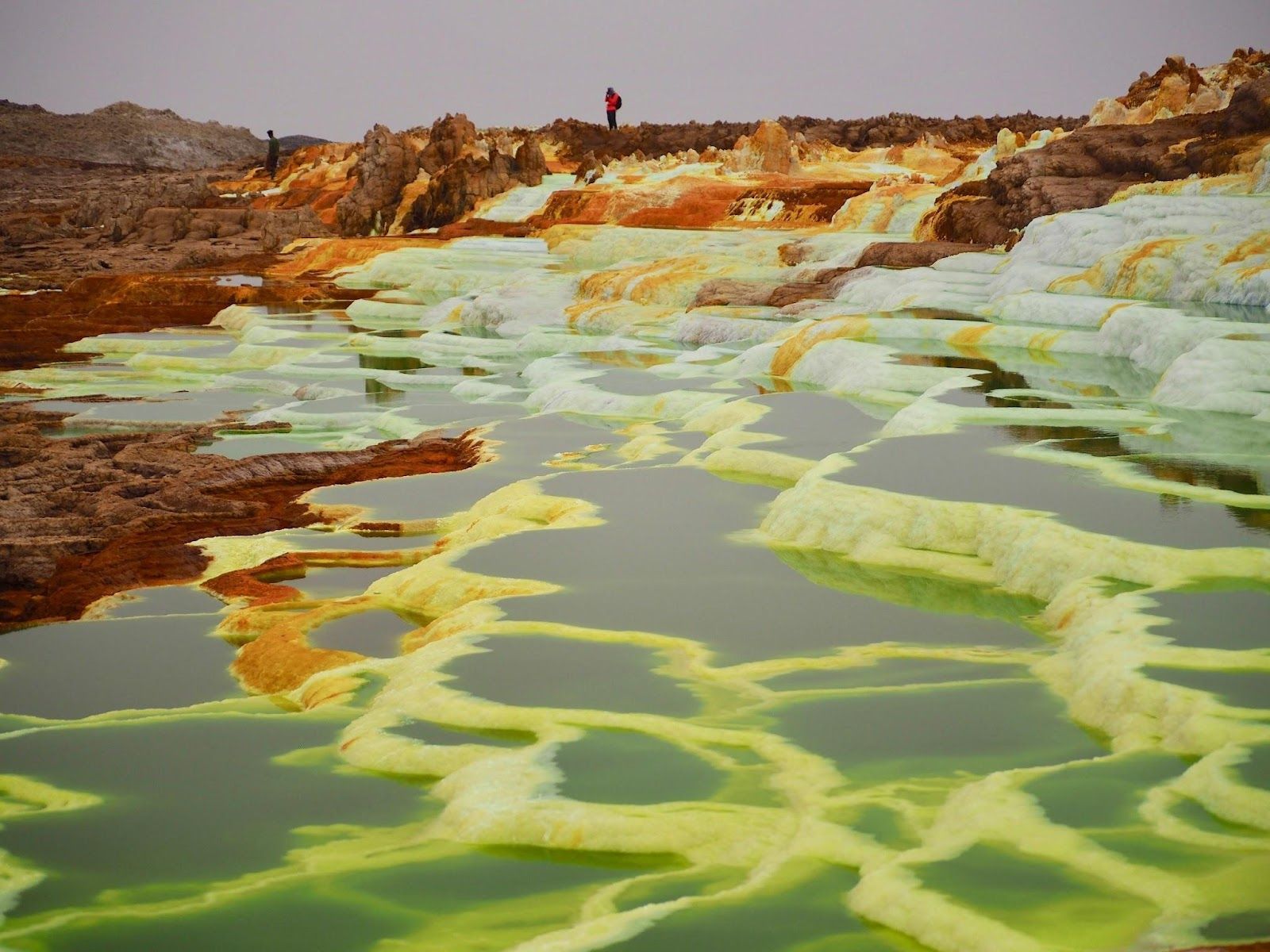 Image: Jorge Tung
Here’s the scenario: temperatures regularly soar above 120°F, while acidic pools, sulfur clouds, and active volcanoes dot the landscape. Even the air can be dangerous; one shouldn’t breathe in those gases for long.
That’s what it’s like in the Danakil Depression in Ethiopia. A place so extreme it looks more like another planet than part of Earth.
The aftermath of a disaster
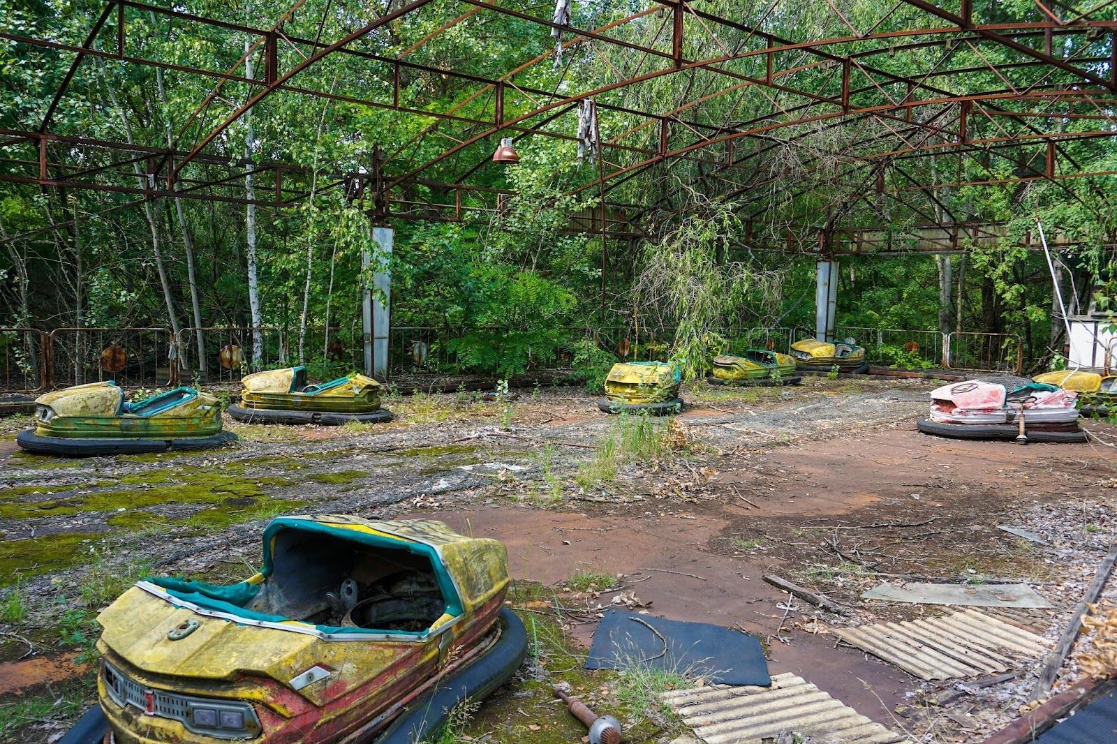 Image: Ilja Nedilko
Let’s not forget the Chernobyl exclusion zone. In 1986, a reactor at the Chernobyl Nuclear Power Plant exploded, releasing massive amounts of radioactive material into the atmosphere.
Nearby Pripyat was evacuated within 36 hours. While radiation levels have dropped significantly since then and limited tourism is now permitted, parts of the exclusion zone remain dangerously contaminated, such as the infamous Red Forest. Staying in Pripyat long-term is still considered unsafe.
A coastline littered with shipwrecks and bones
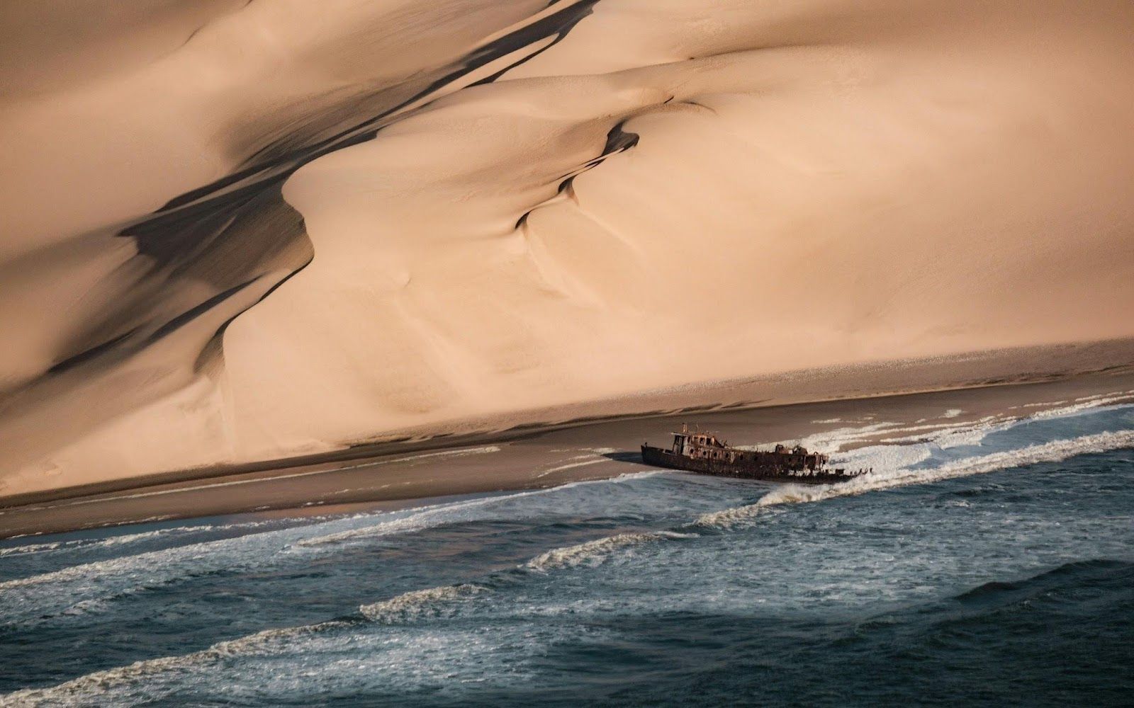 Image: Joshua Kettle
Namibia’s Skeleton Coast earned its name honestly. Dense fog, powerful currents, and shifting sands have caused countless ships to run aground over the centuries.
Survivors who made it to shore often faced an even harsher fate, trapped between the Atlantic Ocean and one of the world’s driest deserts, with little chance of rescue.
An unpredictable volcano looming over nearby towns
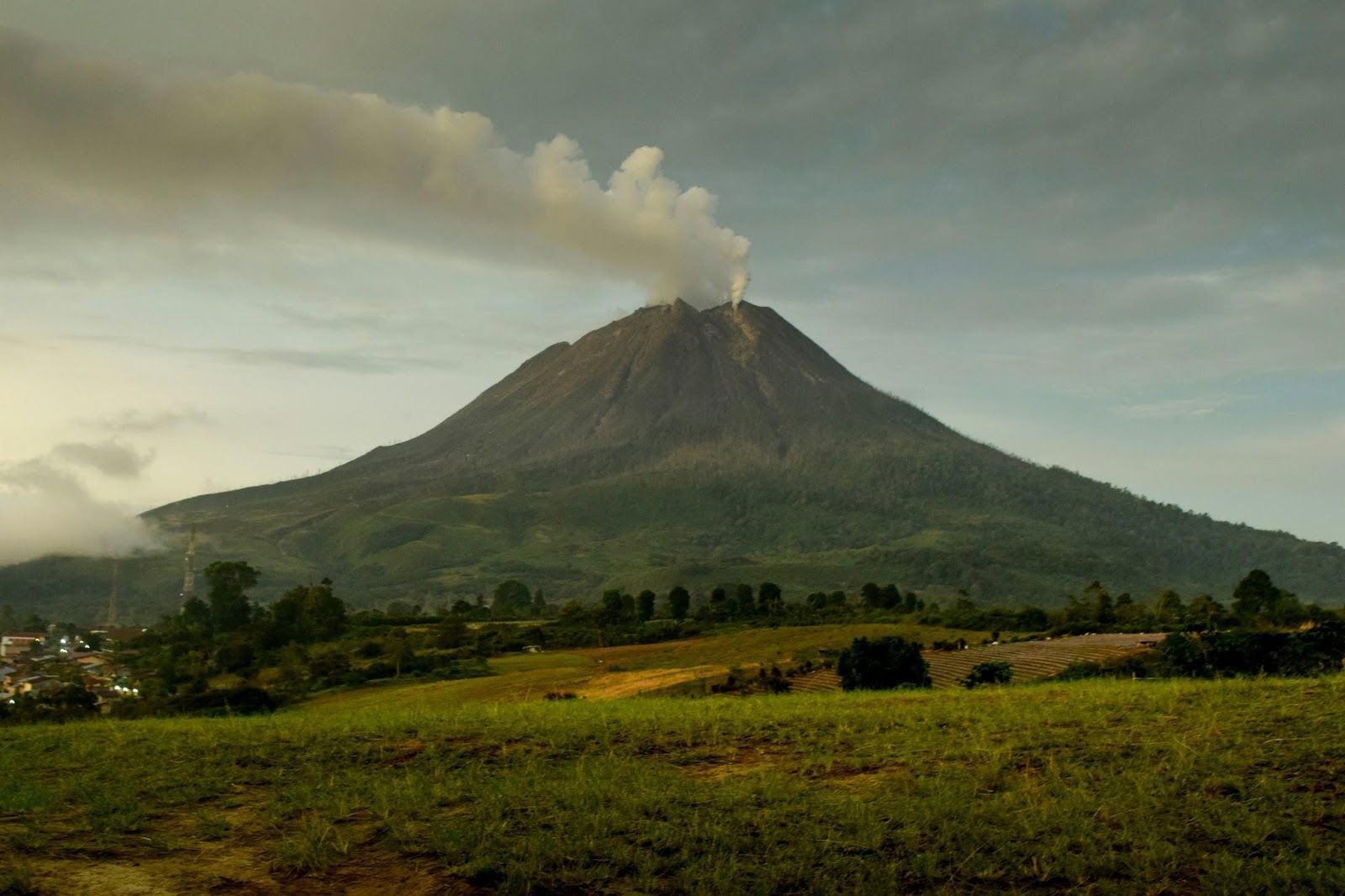 Image: amir hamzah
Mount Sinabung, in Indonesia, was quiet for centuries before reawakening in 2010. Since then, it has erupted repeatedly, sending fast-moving clouds of ash, rock, and superheated gas down its slopes.
These pyroclastic flows are among the deadliest volcanic hazards: if one erupts nearby, there’s little chance of escape. Entire villages have been evacuated and abandoned as the volcano continues to reshape the surrounding landscape.
A rainforest where getting lost can be fatal
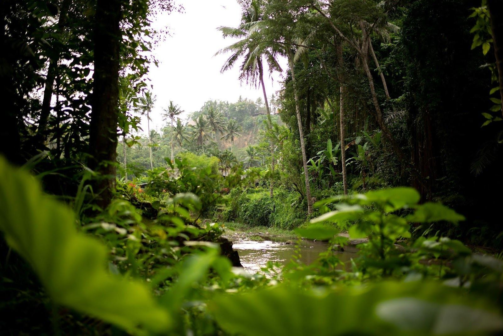 Image: Mark
Finally, let’s not leave out the Amazon rainforest! Some regions are indeed very difficult to survive in. Dense vegetation that erases paths, rivers that shift with the seasons, and humidity that drains energy faster than you would expect.
Add venomous animals, disease-carrying insects, and extreme isolation, and even experienced explorers can find themselves in serious trouble if they become stranded.
Keep wandering
There’s always
more to explore
 General

9 Legendary bands & musicians from around the world
4 min.
Read Now
 Culture

10 American bands & musicians became icons
5 min.
Read Now

Why did Salem believe in witches in 1692? The real reason
5 min.
Read Now

How do airports control passengers' rage? All they need is this
4 min.
Read Now