10 legendary roads and trails meant to be explored on foot

Step by step
10 legendary roads and trails meant to be explored on foot
Before the invention of automobiles, most people traveled on foot. Horses carried messages quickly, and carts transported goods, but daily life still depended largely on walking. From that era, we inherited trails and roads that have survived centuries of use, erosion, and reinvention. They cross deserts, mountains, coasts, and cities, offering walkers a direct encounter with geography and history. Take a walk with us and discover some of the world’s most beautiful trails, one step at a time.
Inca Trail, Peru
 Image: Juan Carlos
Built in the 15th century, this stone-paved trail connected Cusco to Machu Picchu through cloud forests and high Andes passes. Its engineering includes stairways, tunnels, and drainage systems that are still functional today.
The classic route is about 26 miles long and reaches approximately 13,830 feet at Dead Woman’s Pass (locally known as Warmi Wañusqa). Access is tightly regulated to protect archaeological sites and limit erosion.
Camino de Santiago, Spain
 Image: Jarl Panzeri
This medieval pilgrimage network leads to Santiago de Compostela, with bucolic routes spanning Spain, France, and Portugal. Walkers have followed it continuously for over 1,000 years.
The Camino Francés alone covers nearly 485 miles. Waymarking, hostels, and town infrastructure make it one of the world’s most accessible long-distance walks.
Appalachian Trail, USA
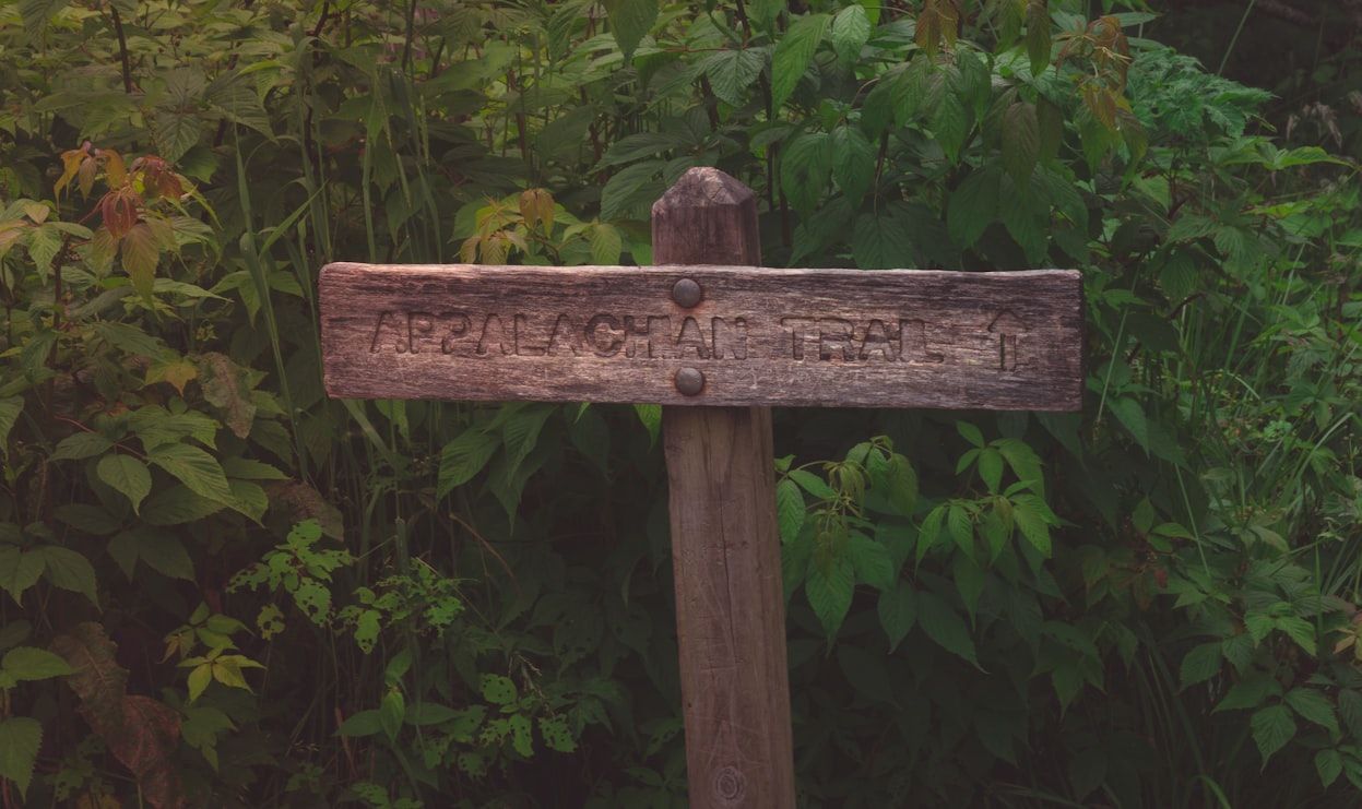 Image: Jeff Ackley
Stretching 2,175 miles from Georgia to Maine, the Appalachian Trail crosses 14 U.S. states and multiple ecosystems. It is maintained largely by volunteer organizations.
Despite its length, the trail avoids roads wherever possible. It passes through over 75 wilderness areas and national parks.
Great Wall Walks, China
 Image: William Olivieri
Several restored and unrestored sections of the Great Wall are open to walkers, especially near Beijing and Hebei. Some segments date back over 2,000 years.
Hiking the wall reveals its military logic—watchtowers, steep gradients, and narrow parapets—built to control movement across northern China.
Milford Track, New Zealand
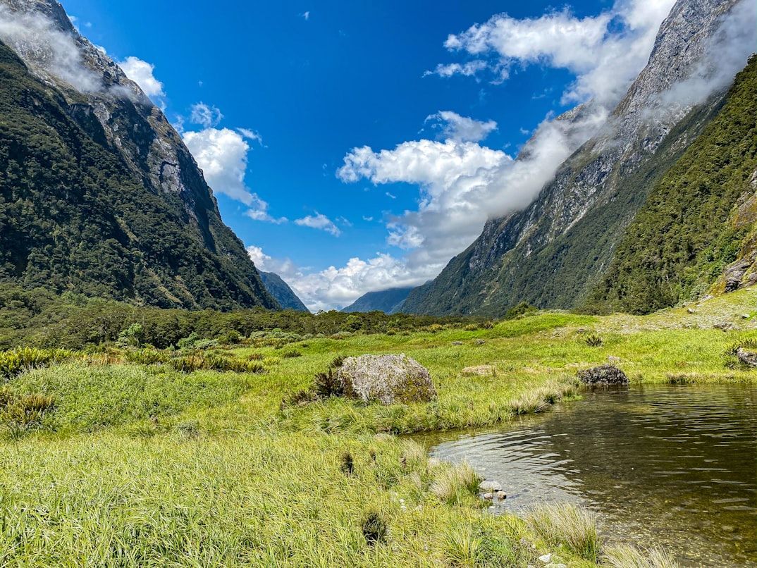 Image: Mac Gaither
Often called "the finest walk in the world," this winding 33-mile trail runs through Fiordland National Park in New Zealand. It crosses glacial valleys, rainforests, and alpine passes.
Annual rainfall exceeds 275 inches in some places. The track operates seasonally with controlled numbers to protect the fragile terrain.
Tour du Mont Blanc
 Image: Ana Frantz
This circular route loops about 106 miles around Mont Blanc, passing through France, Italy, and Switzerland. It connects alpine villages via historic trading paths.
The trail reaches elevations above 8,200 feet. Typically, it can be completed in 7–11 days, thanks to its extensive hut infrastructure.
Via Appia Antica, Italy
 Image: Hasmik Ghazaryan Olson
Rome’s ancient Appian Way was built in 312 BCE and paved with basalt stones. Amazingly, large sections remain walkable today within and beyond the city.
Designed with military needs in mind, the road’s straight alignment and durability influenced Roman road construction across Europe.
Laugavegur Trail, Iceland
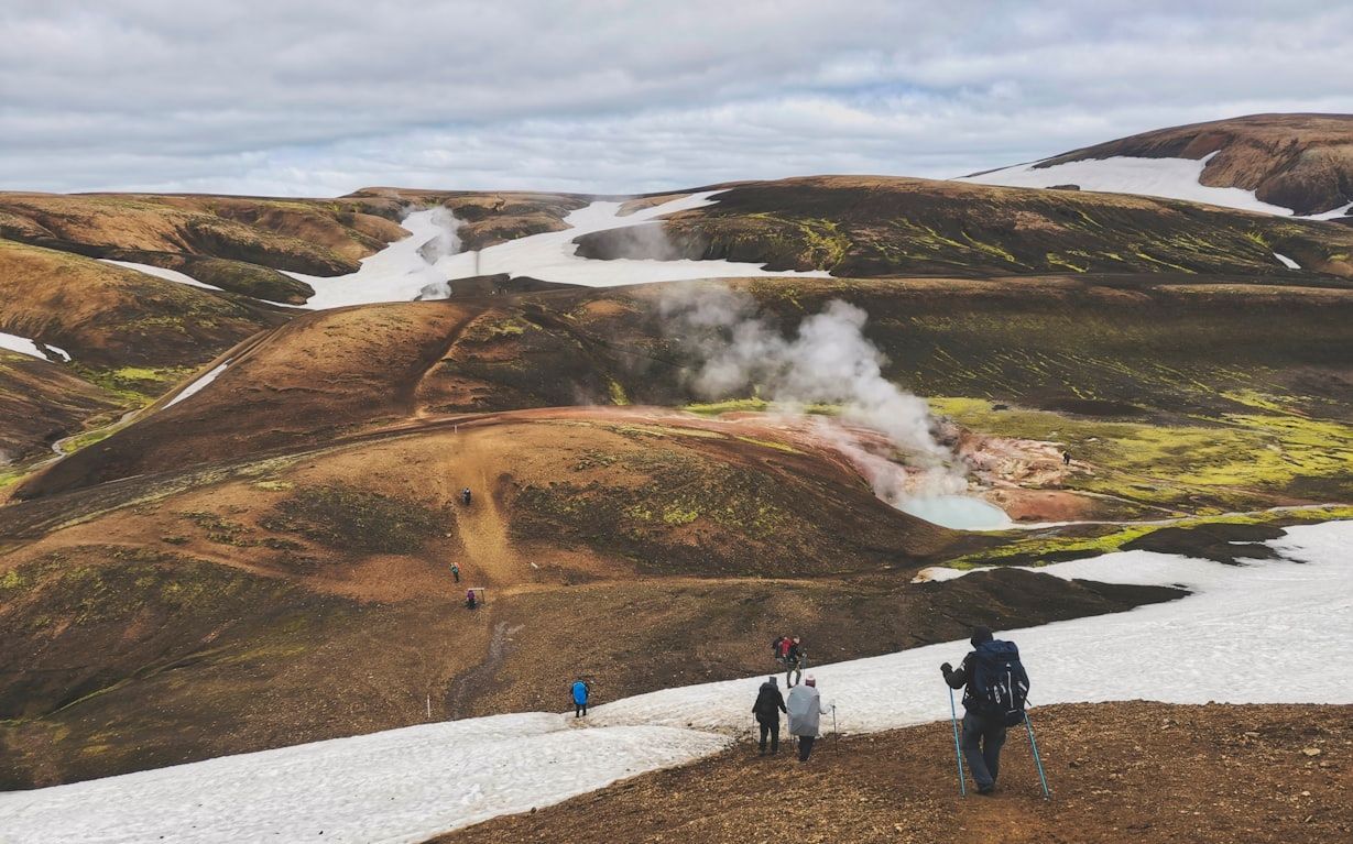 Image: Krisztián Korhetz
This 34-mile trail links Landmannalaugar to Þórsmörk in Iceland, crossing a seemingly alien landscape of contrasts made up of volcanic deserts, hot springs, and glaciers.
Marked routes and hut systems support hikers, but weather can change rapidly due to Iceland’s exposed, treeless terrain.
Hadrian’s Wall Path, England
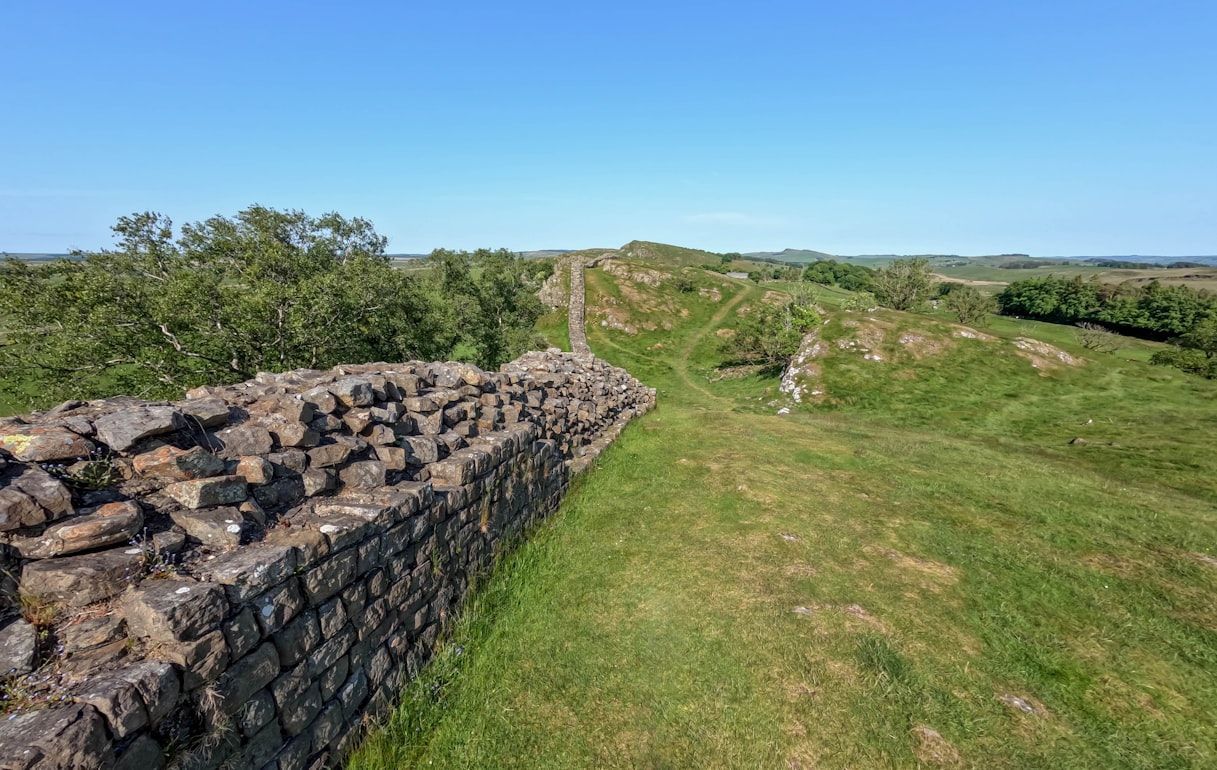 Image: Ray Harrington
This 84-mile trail follows what was once the northern boundary of Roman Britain, built under Emperor Hadrian in the 2nd century CE.
The route runs alongside surviving sections of the original wall, allowing walkers to pass forts and milecastles. Combining archaeology with open moorland walking, it is one of the most unique long-distance experiences in the British Isles.
Pacific Crest Trail, USA
 Image: Olivier M
Running about 2,650 miles from Mexico to Canada, the Pacific Crest Trail crosses deserts, the Sierra Nevada, and the Cascade Range.
Snowpack, elevation, and remote sections define the challenge. Elevations range from roughly 110 feet above sea level near the Bridge of the Gods on the Oregon–Washington border to 13,153 feet at Forester Pass in the Sierra Nevada.
More to explore

4 min read
These are the coziest places to visit in the United States
Read Now

4 min read
The staff has spoken: 10 Hotel secrets most guests never notice
Read Now

5 min read
U.S. road trips everyone should do at least once
Read Now

4 min read
What to do with your hotel room key and 9 other infallible safety tips
Read Now