What happened to the third-largest city in Nevada? 10 US ghost towns
 Landmarks
What happened to the third-largest city in Nevada? 10 US ghost towns
There is a melancholic beauty in spaces that humanity built, cherished, and ultimately left behind. From the remnants of gold rush settlements to bypassed highway oases, thousands of abandoned towns across the United States offer a glimpse into the fleeting nature of American expansion. These 10 abandoned sites represent some of the most fascinating ghost towns and forgotten settlements in the nation.
Bodie, California
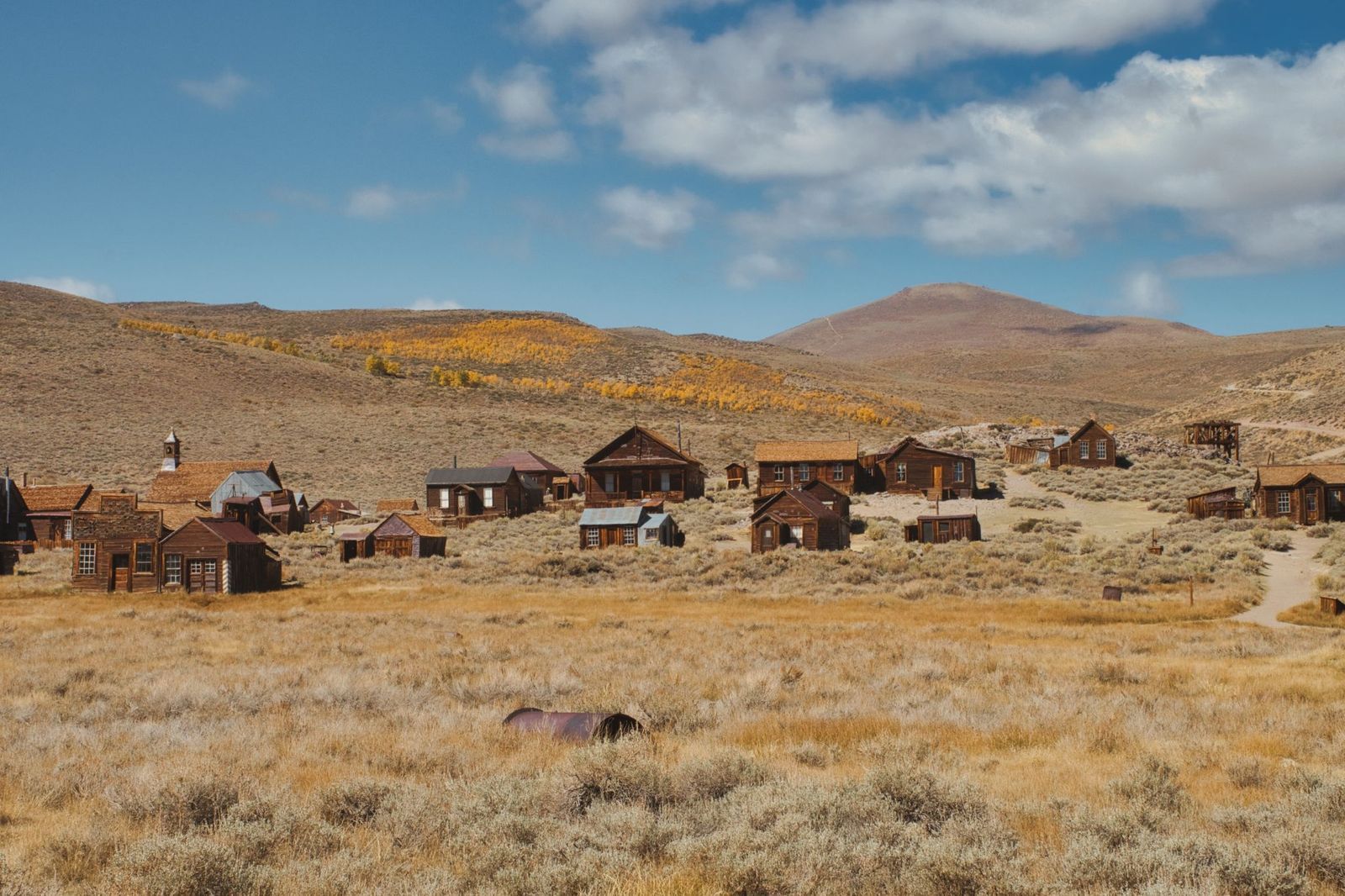
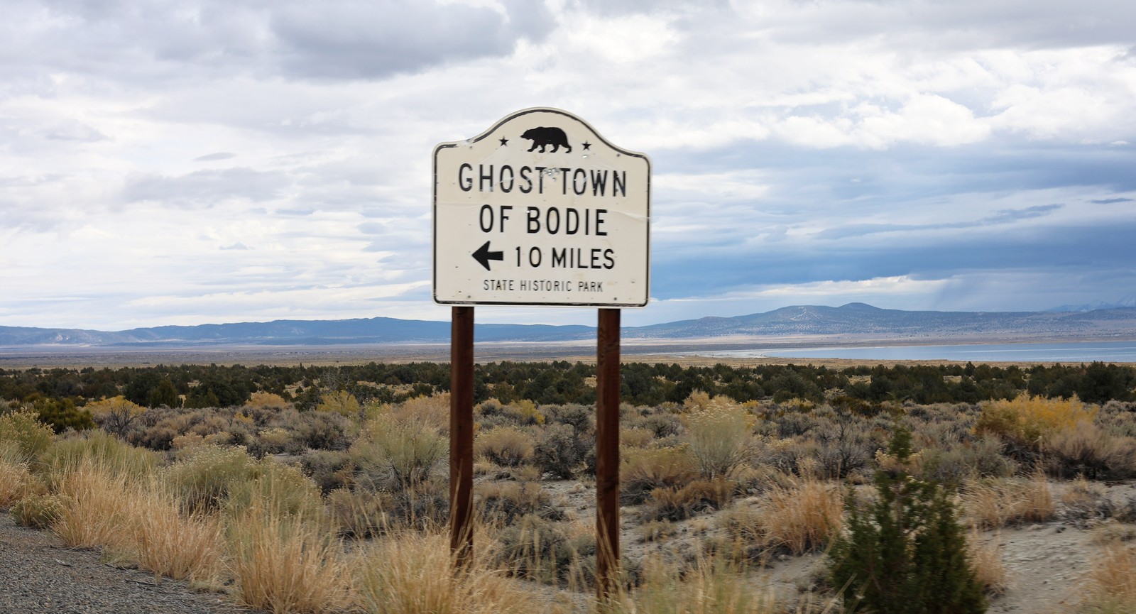
Located in a remote basin of the Sierra Nevada mountains, Bodie is perhaps the quintessential American ghost town. In the late 1870s, it was a booming gold mining hub of nearly 10,000 residents, infamous across the West for its rowdy saloons and lawlessness. When the gold dried up, the population evaporated.
Nowadays, Bodie is maintained by California State Parks. Although the buildings are protected from collapsing, they’re not sanitized or rebuilt. Visitors can walk the dusty streets and peer through the windows to see tables still set with dishes and store shelves stocked with old merchandise, looking exactly as they did a century ago.
Santa Claus, Arizona
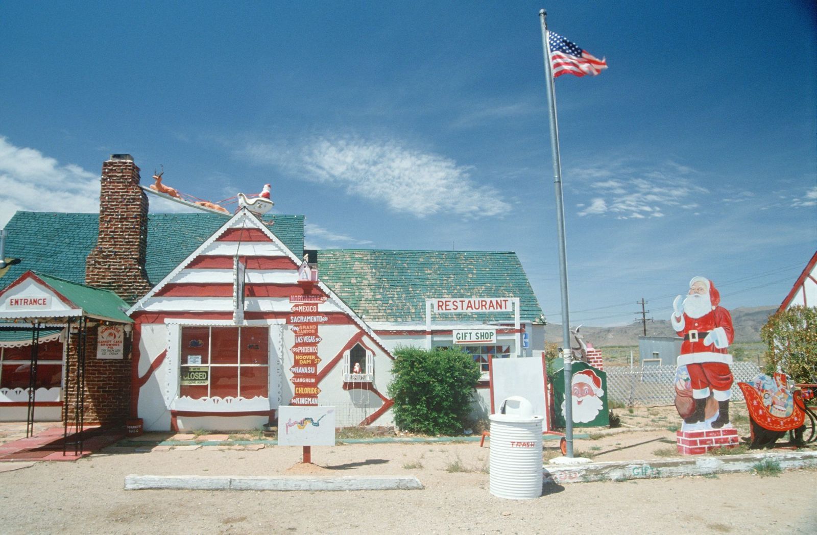
Hidden in the hot Mojave Desert along Route 66, Santa Claus was a bizarre oasis built in the 1930s by a real estate developer called Nina Talbot. The goal was to create a whimsical, Christmas-themed resort town to draw land buyers out to the desert. For a few decades, families stopped to eat at the famous Christmas Tree Inn, and children mailed letters stamped directly from Santa Claus.
By the 1970s, the novelty wore off, the highway traffic shifted, and the town fell into decay. Today, the festive structures are covered in desert grime and graffiti, offering a surreal contrast against the blistering desert sun.
Shaniko, Oregon
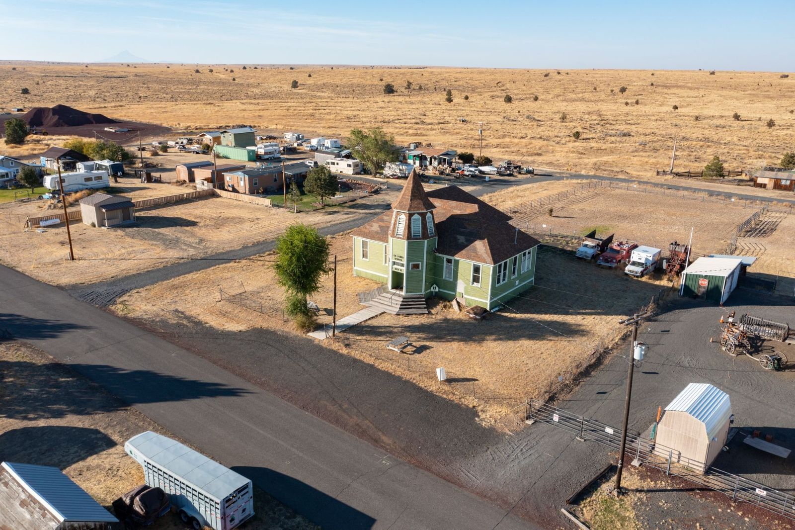
Once proudly known as the "Wool Capital of the World," Shaniko was the bustling epicenter of Oregon’s sheep farming empire at the dawn of the 20th century. Millions of pounds of wool moved through its warehouses every year.
However, when a new railway line bypassed the town in 1911, the local economy took a fatal blow from which it never recovered. While a small handful of residents still live in the surrounding rural area, the historic town center remains a perfect snapshot of the Old West, with its preserved wooden water tower, schoolhouse, old brick jail, and historic hotel.
St. Elmo, Colorado
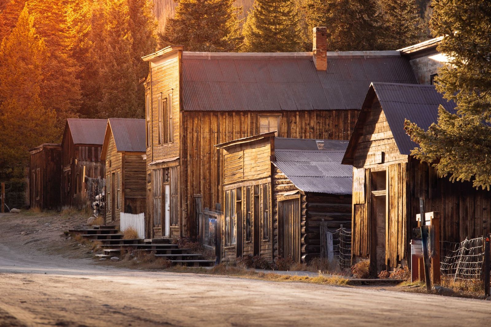
Perched high in the Sawatch Range of the Rocky Mountains at an elevation of nearly 10,000 feet, St. Elmo is one of Colorado’s best-preserved ghost towns. Founded in 1880, it was a vital supply hub for thousands of miners searching for silver and gold in the surrounding hills.
When the mining industry collapsed and the local railroad line closed down in the 1920s, the town emptied out, leaving the structures at the mercy of the alpine elements. St. Elmo’s wood-frame storefronts, dusty main street, and mountain backdrop make it feel like walking directly onto a historical movie set.
Virginia City, Montana
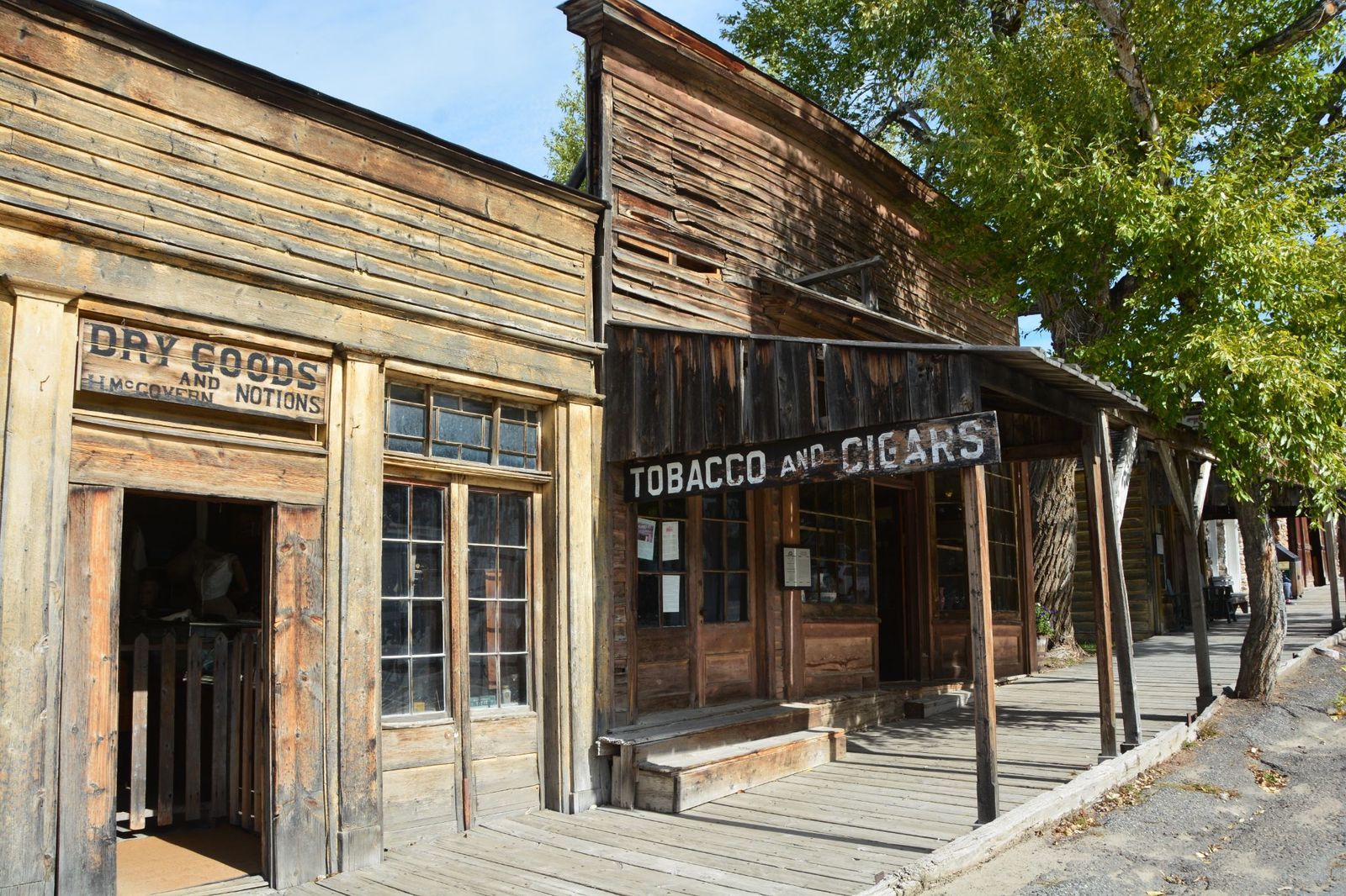
Virginia City was born out of a gold discovery in Alder Gulch in 1863, rapidly growing into a city of 10,000 that served as the capital of the Montana Territory. Unlike many towns that collapsed into ruin, Virginia City’s historical buildings were bought in the mid-20th century by a preservationist couple, Charles and Sue Bovey. Today, it operates as an outdoor living history museum, frozen in the mid-Victorian era, where visitors can walk wooden boardwalks and admire fully furnished shops, bars, and homes.
Batsto Village, New Jersey
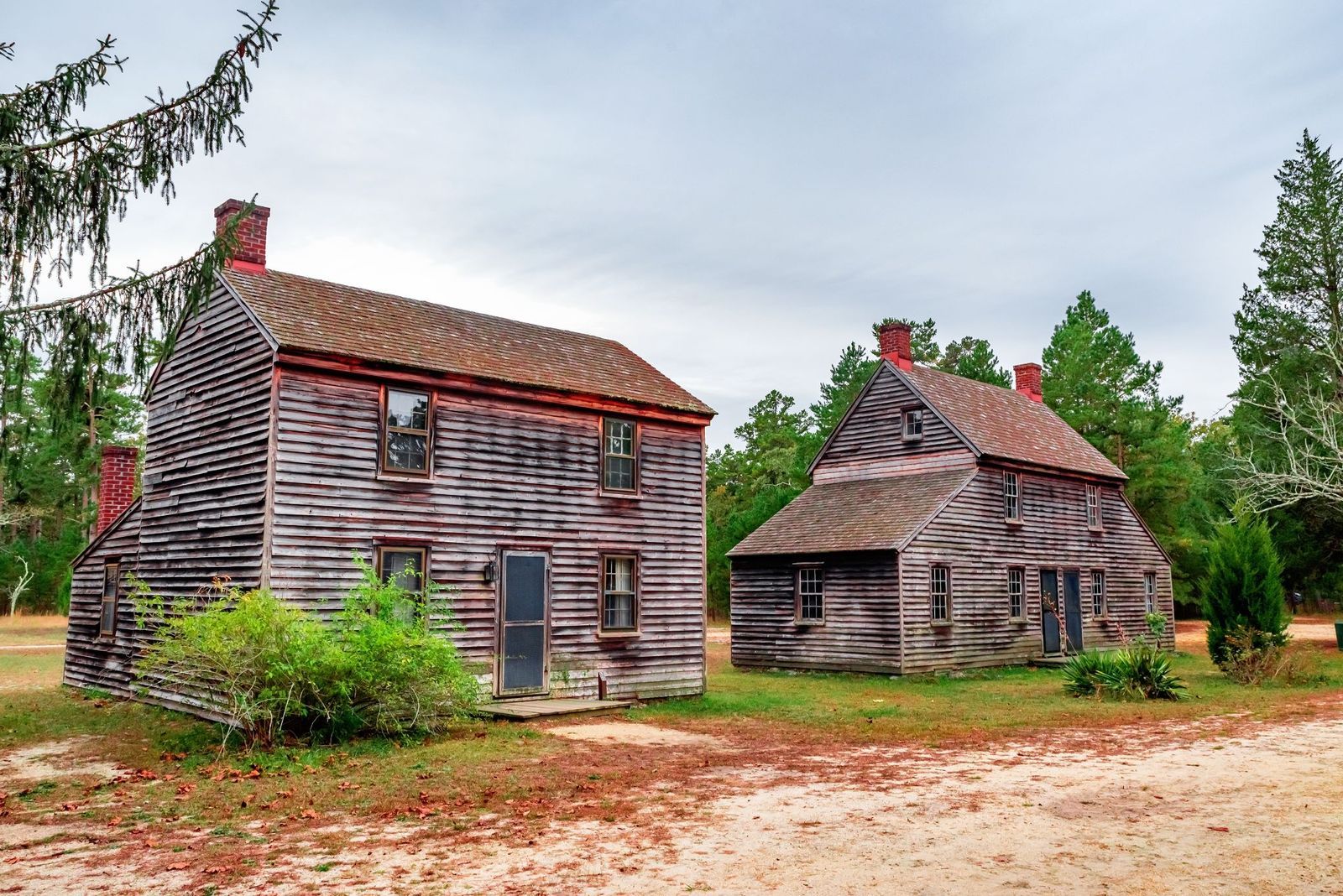
Located within the Pine Barrens, Batsto Village has deep historical roots stretching back to 1766. It was a crucial early American industrial center that manufactured iron products, including cannonballs and camp kettles for the Continental Army during the Revolutionary War.
As coal mining and steel mills advanced elsewhere in the country, Batsto’s iron industry became obsolete. The town was abandoned by its workers in the late 19th century. Today, the state preserves the site, showcasing a stunning 32-room mansion, a working gristmill, a blacksmith, and worker cottages.
Centralia, Pennsylvania
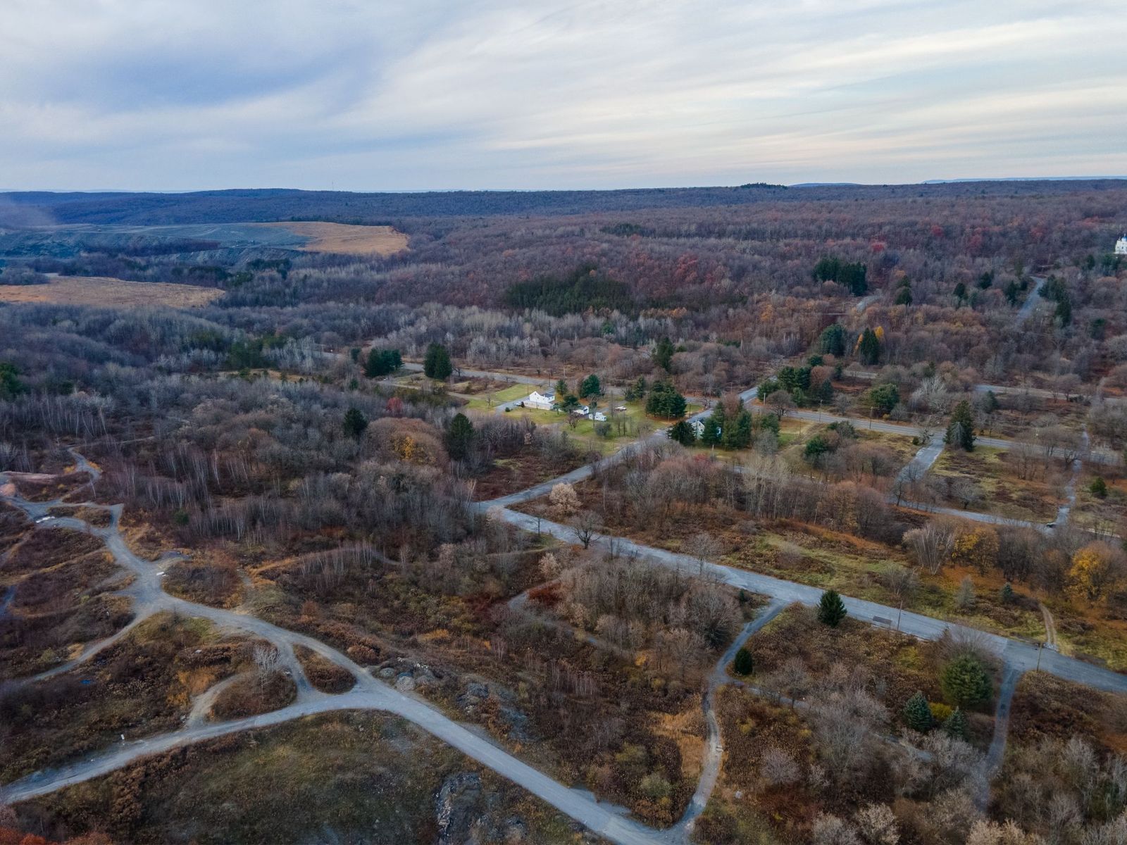
Unlike the resource exhaustion that emptied out most western ghost towns, Centralia was doomed by an ongoing environmental catastrophe. In 1962, a trash fire in an abandoned mine pit accidentally ignited a labyrinth of coal seams running beneath the town.
The subterranean fire has been burning ever since, emitting toxic gases, creating random sinkholes, and cracking highways. Over the decades, the government relocated nearly all residents for safety. Only a handful of homes remain amidst a grid of empty streets.
Glenrio, Texas/New Mexico
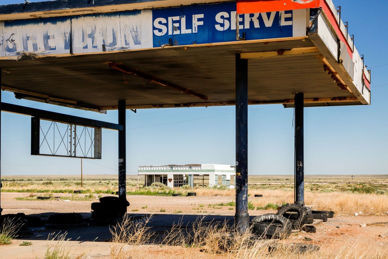
Glenrio was once an oasis for motorists traveling down the historic Route 66, just at the state line of Texas and New Mexico. It featured gas stations, the "First/Last Motel in Texas," and lively diners feeding travelers.
Its death sentence arrived with the construction of Interstate 40 in the 1970s, which bypassed the town. Drivers no longer had reason to exit, and Glenrio was left to the desert elements. Today, travelers can still visit the town’s mid-century modern neon signs, abandoned gas pumps, and decaying diners.
Kennecott, Alaska
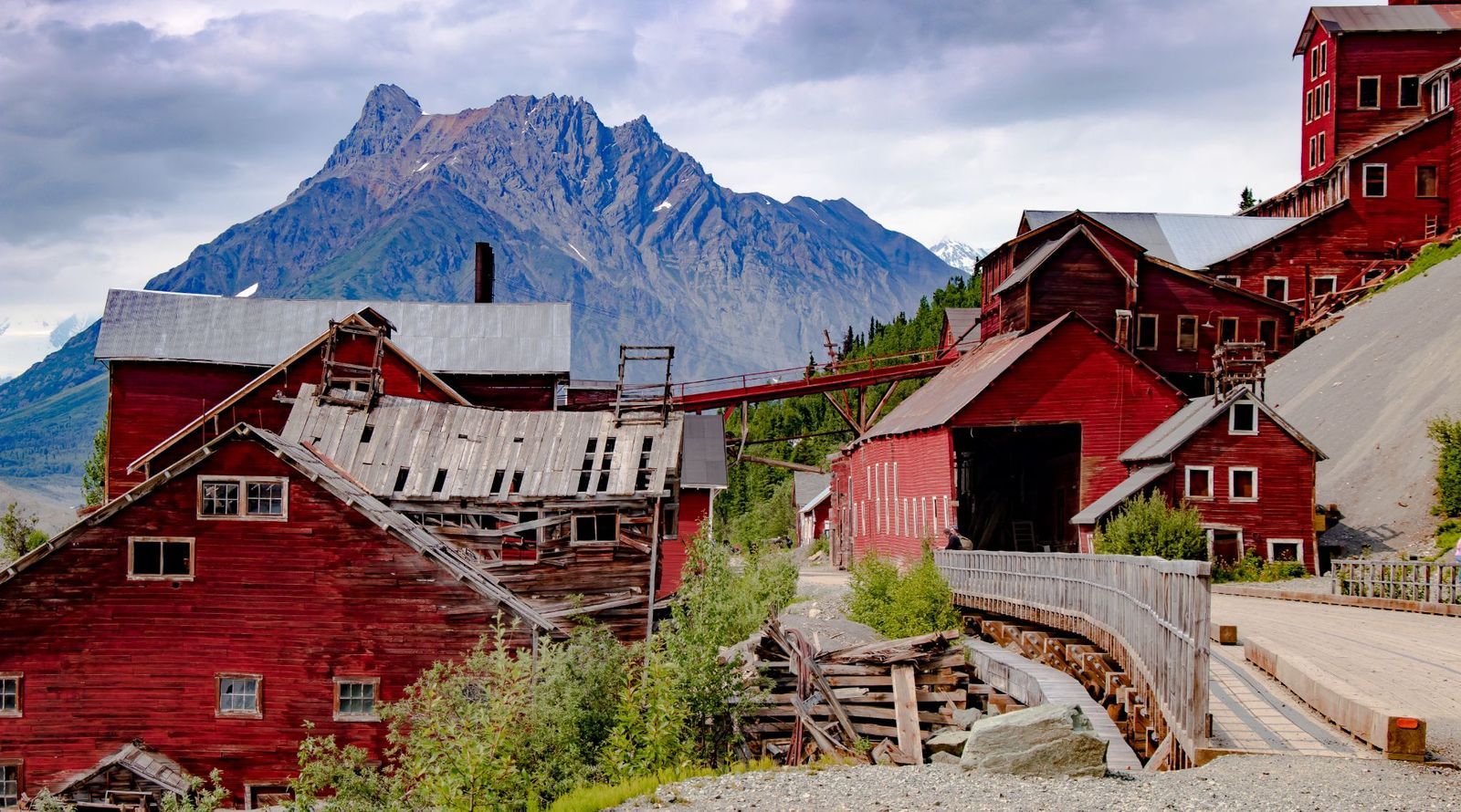
Within the rugged wilderness of Wrangell-St. Elias National Park lies Kennecott, an abandoned copper mining camp. From 1911 to 1938, the Kennecott Copper Corporation processed hundreds of millions of dollars' worth of copper ore here. When the mountain was cleared of its wealth, the company ceased operations and abandoned the town. What remains is a series of towering wooden industrial structures painted a vibrant red, clinging to the side of the mountain adjacent to a glacier.
Rhyolite, Nevada
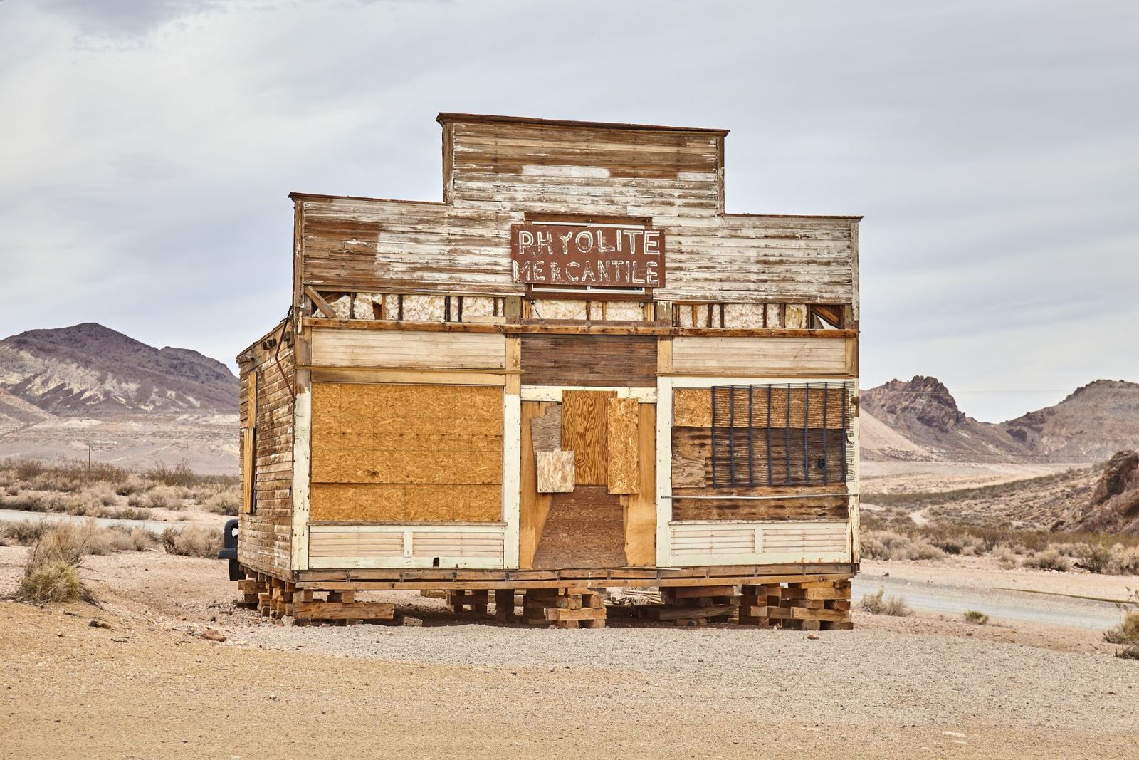
Rhyolite bloomed almost overnight in 1905 during the Bullfrog gold rush, quickly building hotels, an opera house, a school, and electric streetlights. Its decline was just as meteoric; by 1920, the town was empty. Even though it was briefly the third-largest city in Nevada, a major financial crash in 1907 caused banks to go out of business. Its most famous mine stopped running in 1911, and within a few years, the last residents had packed up and left.
If you’d like to visit, Rhyolite still boasts dramatic ruins that look like ancient relics against the rough Mojave Desert backdrop.
The strangest landscapes on Earth, from frozen bubbles to fairy circles
 Geography
Decoding mysterious shapes
Have you ever seen rocks shaped like this? Unique landscapes of the world
A beach with piles of shiny, giant marbles. A desert floor where rocks seem to move on their own. A lake that traps frozen bubbles under its surface. In this collection, we’ll travel all around the globe, stopping at landscapes so odd and unusual that you'll want to hear their stories and marvel at them.
Racetrack Playa, Death Valley, California
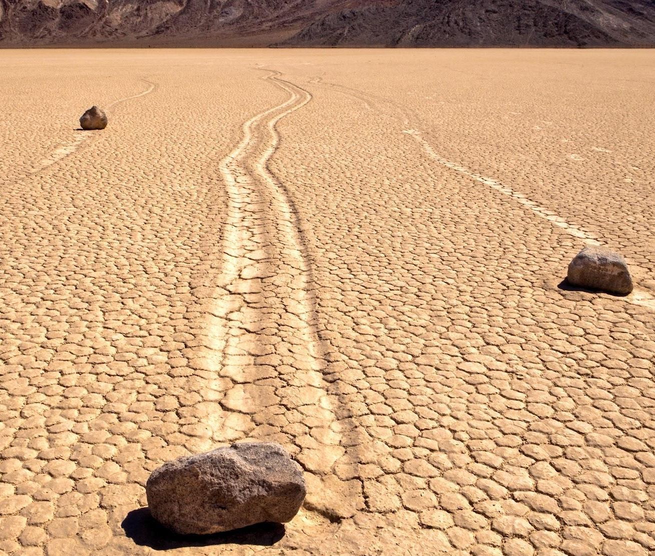
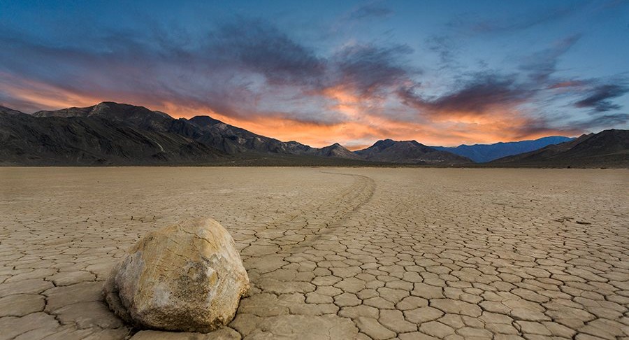
In a remote corner of Death Valley National Park, in California, US, lies one of geology’s most puzzling sights: rocks that appear to move on their own, leaving trackmarks on a dry, cracked clay lakebed.
This flat expanse is etched with trails of rocks that have slid across the ground, some weighing up to 700 pounds. The mystery was finally solved in 2014. As scientists explained, ice forms overnight in the area, forming a thin sheet; as the morning sun melts it, it becomes slippery, which helps the wind gently push the rocks forward just a few inches per second every day.
Spotted Lake, British Columbia, Canada
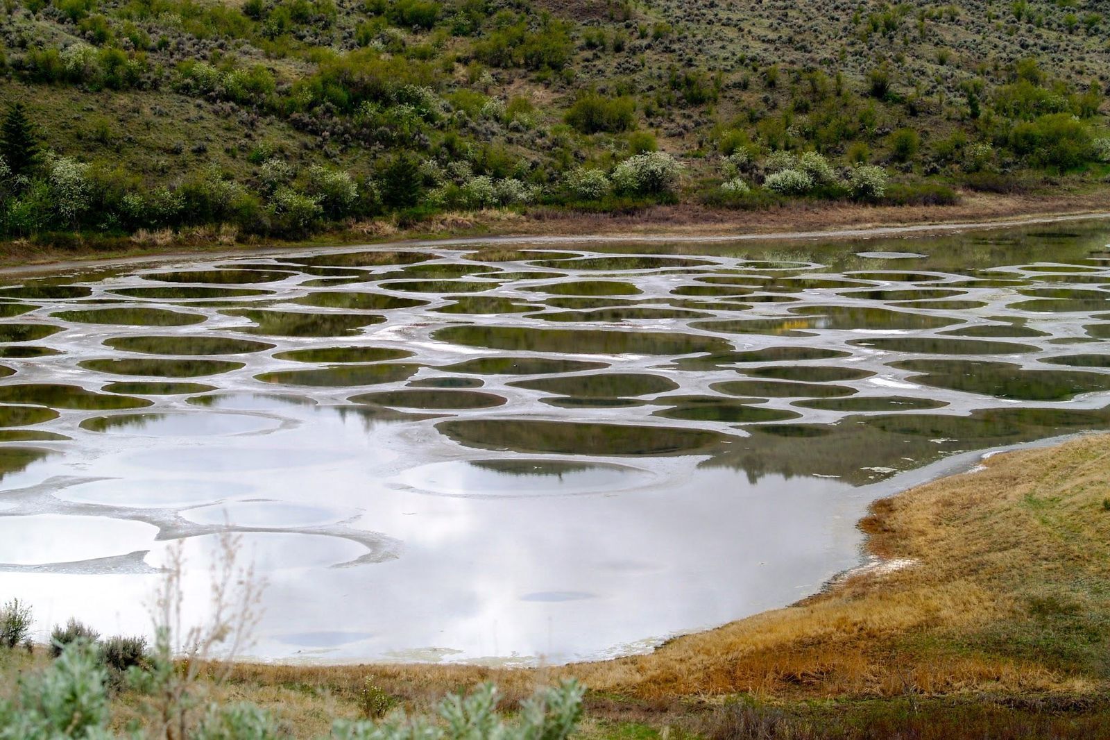
This small lake in the Okanagan Valley transforms each summer. As temperatures rise, the evaporating water reveals hundreds of "spots" formed by high concentrations of minerals, like magnesium sulfate, calcium, and traces of silver and titanium.
Each mineral crystallizes in different shades, like white, green, yellow, and brown. The polka-dotted lake has been known for centuries, and the indigenous Syilx (Okanagan) people considered it sacred for its healing properties. It is one of the most mineralized lakes in the world.
Lake Abraham, Canada
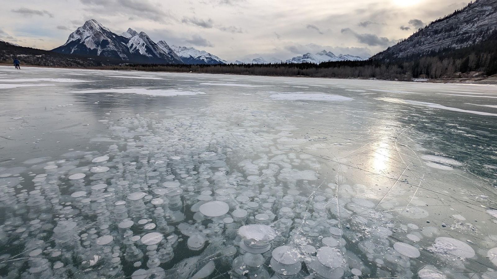
On certain winter days, visitors will be able to find a gallery of trapped bubbles that look like alien plants under the surface of Abraham Lake, in Alberta, Canada. This artificial reservoir was created in 1972 with the construction of the Bighorn Dam.
The striking phenomenon of the white bubbles is due to methane gas released by decaying organic matter on the lakebed. The gas becomes trapped under layers of ice as temperatures drop. Stunning, yes, but these methane bubbles would be flammable if released.
Giant’s Causeway, Northern Ireland
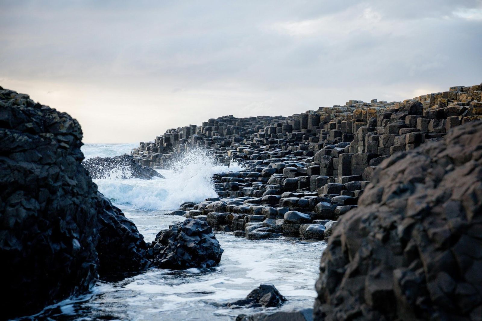
The stones of Giant’s Causeway form a landscape so geometric that it seems man-made. But it was nature that shaped it as it is. This is a UNESCO World Heritage Site featuring approximately 40,000 interlocking basalt columns that step down like stairs into the North Atlantic.
The formation dates back about 50 million years, when volcanic activity caused molten basalt to cool rapidly. As lava contracted, it fractured into the striking hexagonal shapes we can see today. The local folklore offers a more colorful explanation, though: the columns were built by the Irish giant Finn McCool as a bridge to Scotland, hence the name of the area.
Moeraki Boulders, New Zealand
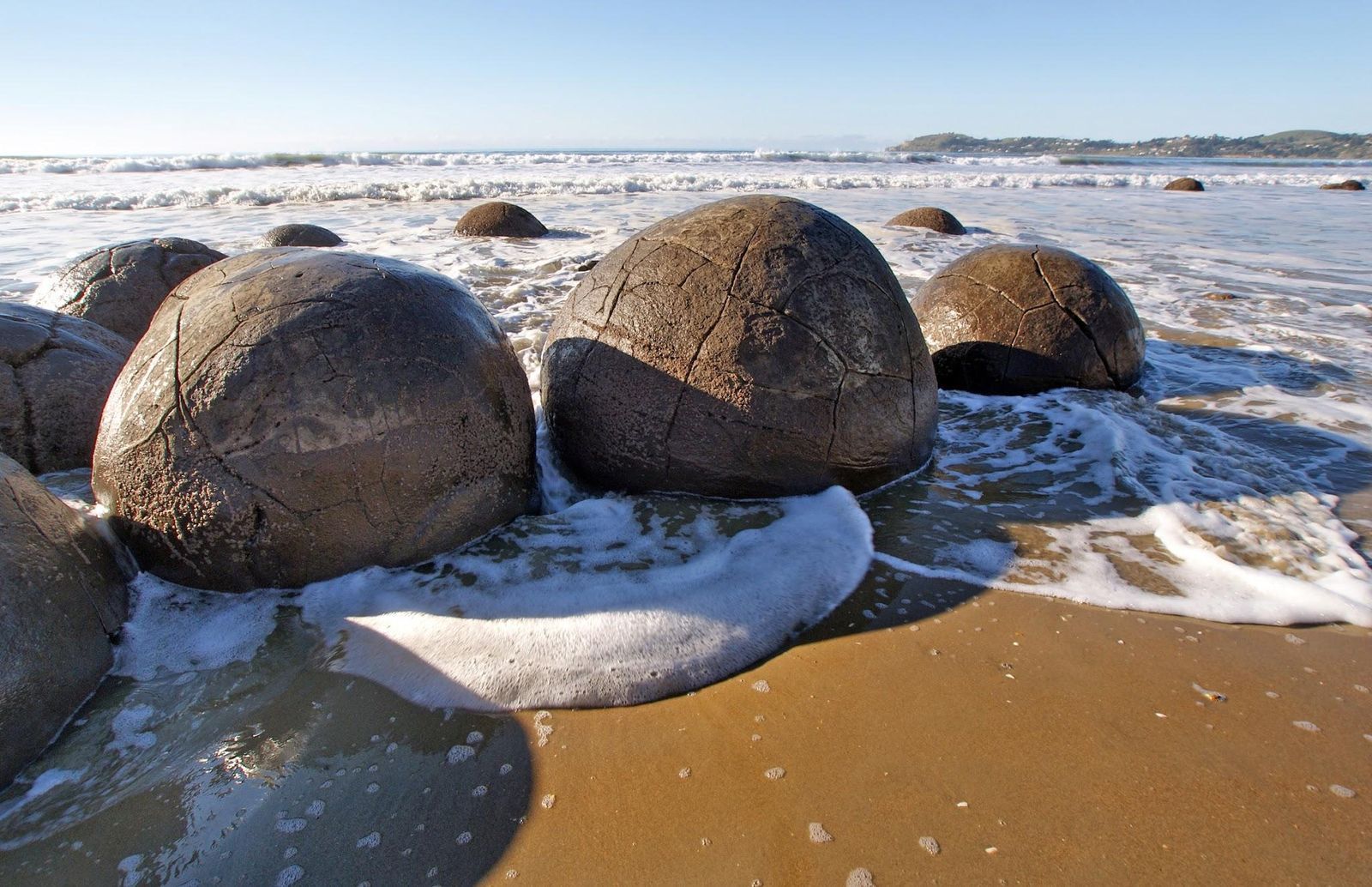
Scattered along Koekohe Beach on New Zealand’s South Island, these boulders look almost too perfect to be natural. They are massive, nearly spherical rocks, some measuring 7 feet in diameter.
Geologists now know that the boulders formed around 60 million years ago during the Paleocene period. They began as small mineral accumulations within marine sediment, which gradually grew as minerals crystallized around a central core. Some of them have cracked open, revealing their interior of intricate patterns filled with calcite crystals.
Mount Roraima in the clouds, South America (3 countries)
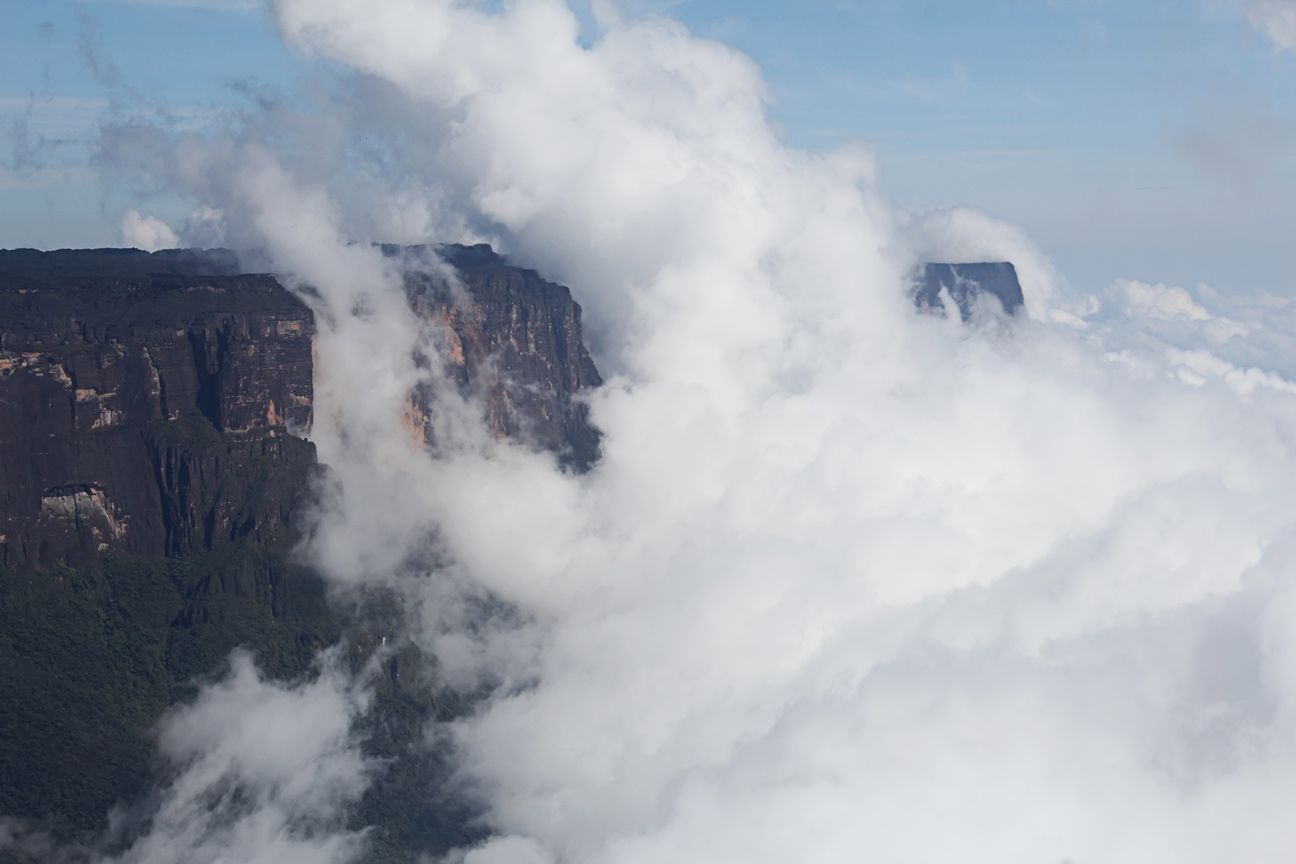
Sometimes, thick clouds will completely engulf the top of Mount Roraima, which sits in the frontier point between Venezuela, Brazil, and Guyana, in South America. Its flat top spans 12 square miles at an elevation of 9220 feet. That’s high enough for it to reach the clouds, becoming a mythical, eerie presence.
The isolation that Mount Roraima exists in has created a unique ecosystem, with plant species found nowhere else, including carnivorous plants adapted to nutrient-poor soils.
Diquís Stone Spheres, Costa Rica
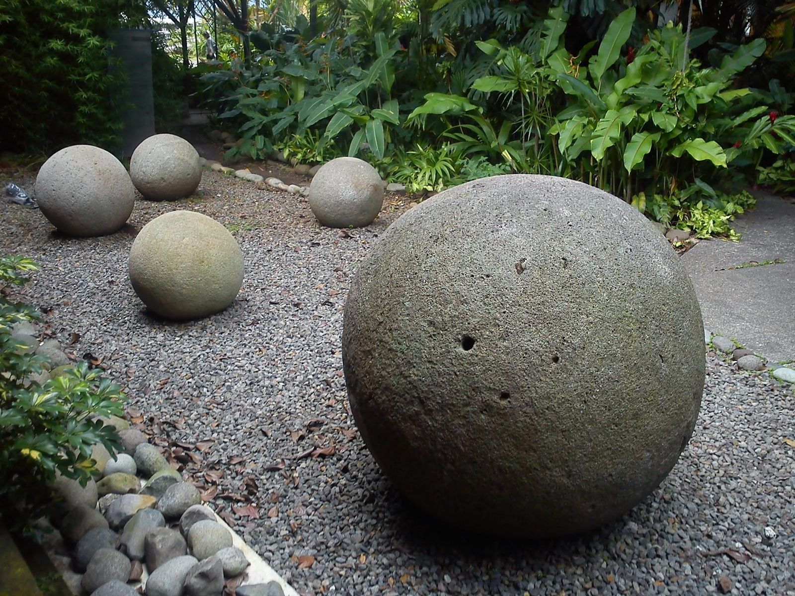
Contrary to those found in New Zealand, these giant rocks were not shaped by the forces of nature. They were very deliberately carved from a hard igneous rock called granodiorite by pre-Columbian societies, roughly between 300 and 1500 CE. Researchers haven’t been able to figure out their purpose, but they can agree that they were shaped using stone tools, heat, and abrasion techniques.
What’s shocking about them is their impeccable roundness and smoothness. They can be found in southern Costa Rica, at the Diquís Delta, scattered across the land. To date, more than 300 spheres have been recorded, some measuring a few inches, some over 6.5 feet.
Bent trees of Slope Point, New Zealand
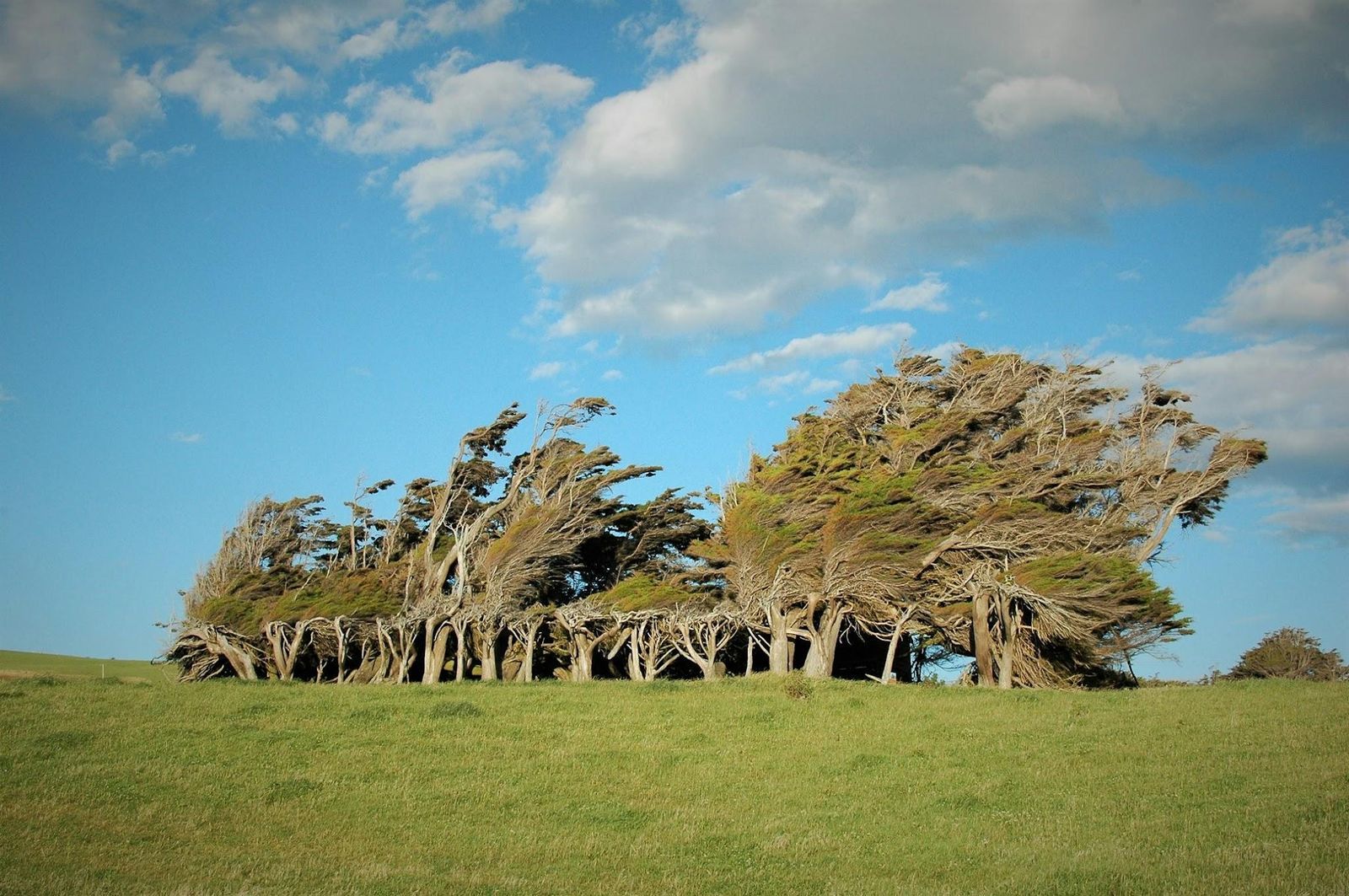
In this picture, it might appear that a strong wind is bending the trees sideways. But that is what the trees of Slope Point, New Zealand, look like on a regular day. This southern, remote coastal spot faces the full force of the winds sweeping up from Antarctica, exceeding 60 miles per hour. The result is a remarkable sculpture garden, and trees permanently twisted.
Great Blue Hole, Belize
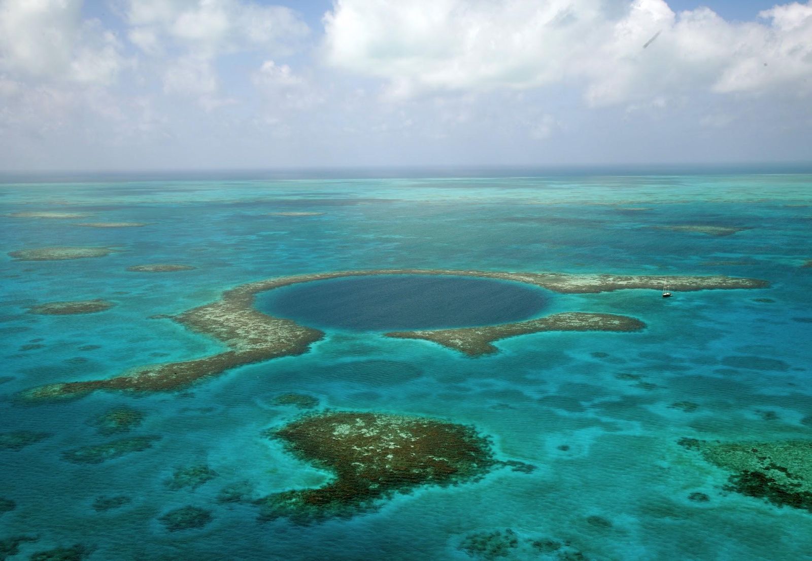
Off the coast of Central America, near the heart of the Belize Barrier Reef, lies one of the ocean’s most striking natural formations: the Great Blue Hole. This nearly perfect circular sinkhole measures about 1,043 feet across and plunges roughly 400 feet deep. It formed during the last Ice Age, when the area was a limestone cave system.
Beneath its deep blue surface, divers encounter stalactites—clear evidence of its dry past—along with reef sharks and other marine life. The site gained international fame in 1971 when French explorer Jacques Cousteau declared it one of the world’s top diving spots.
Fairy Circles, Namibia
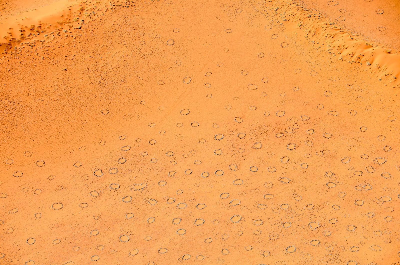
They may look like spots on an animal’s fur, but these Fairy Circles are nearly perfect shapes that range from 6.5 to 65 feet in diameter. They sometimes appear in vast, evenly spaced fields that extend for hundreds of miles.
They stretch across the arid grasslands of the Namib Desert, and their origin has sparked intense debate for decades. Are they remnants of cleared vegetation? Underground gases? Traces left by toxic plants? Research from the 2020s suggests that it results from termite activity interacting with the behavior of grasses competing for scarce resources. Of course, older folklore suggests other explanations, like spirits or dragons beneath the earth.
Symphony of Stones, Armenia
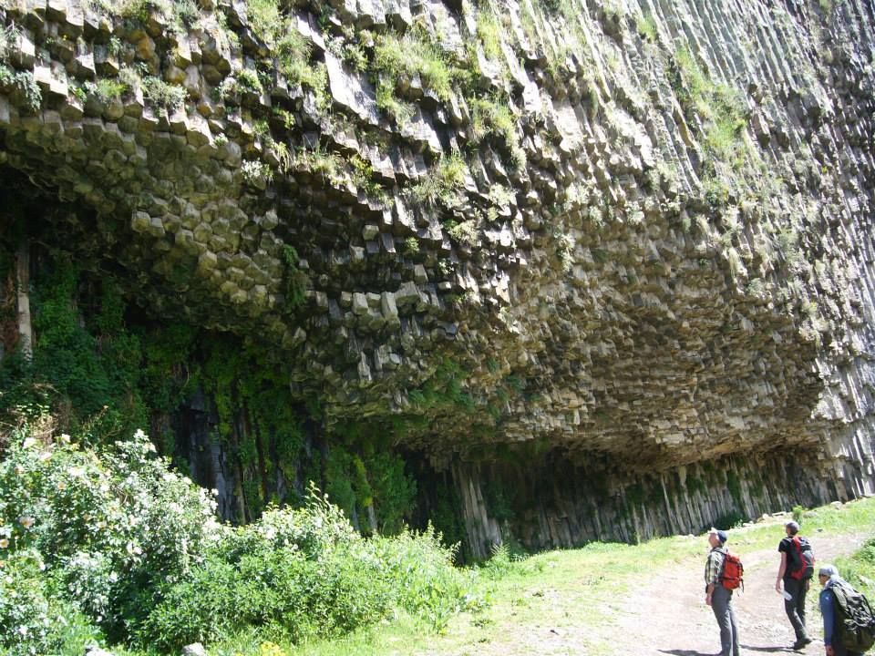
In a narrow gorge carved by the Azat River, the Symphony of Stones rises as one of Armenia’s most striking landscapes. This cliff face is composed of towering basalt columns that resemble the pipes of a giant organ.
The formation reaches up to 160 feet, with thousands of hexagonal columns tightly packed together. They formed millions of years ago through cooled molten lava contracting and cracking, a process known as columnar jointing.
Keep wandering
There’s always
more to explore

What's hiding beneath Alcatraz, and why can't anybody visit it?
6 min.
Read Now
 General

What should you do if you lose your passport while traveling?
4 min.
Read Now
 Culture
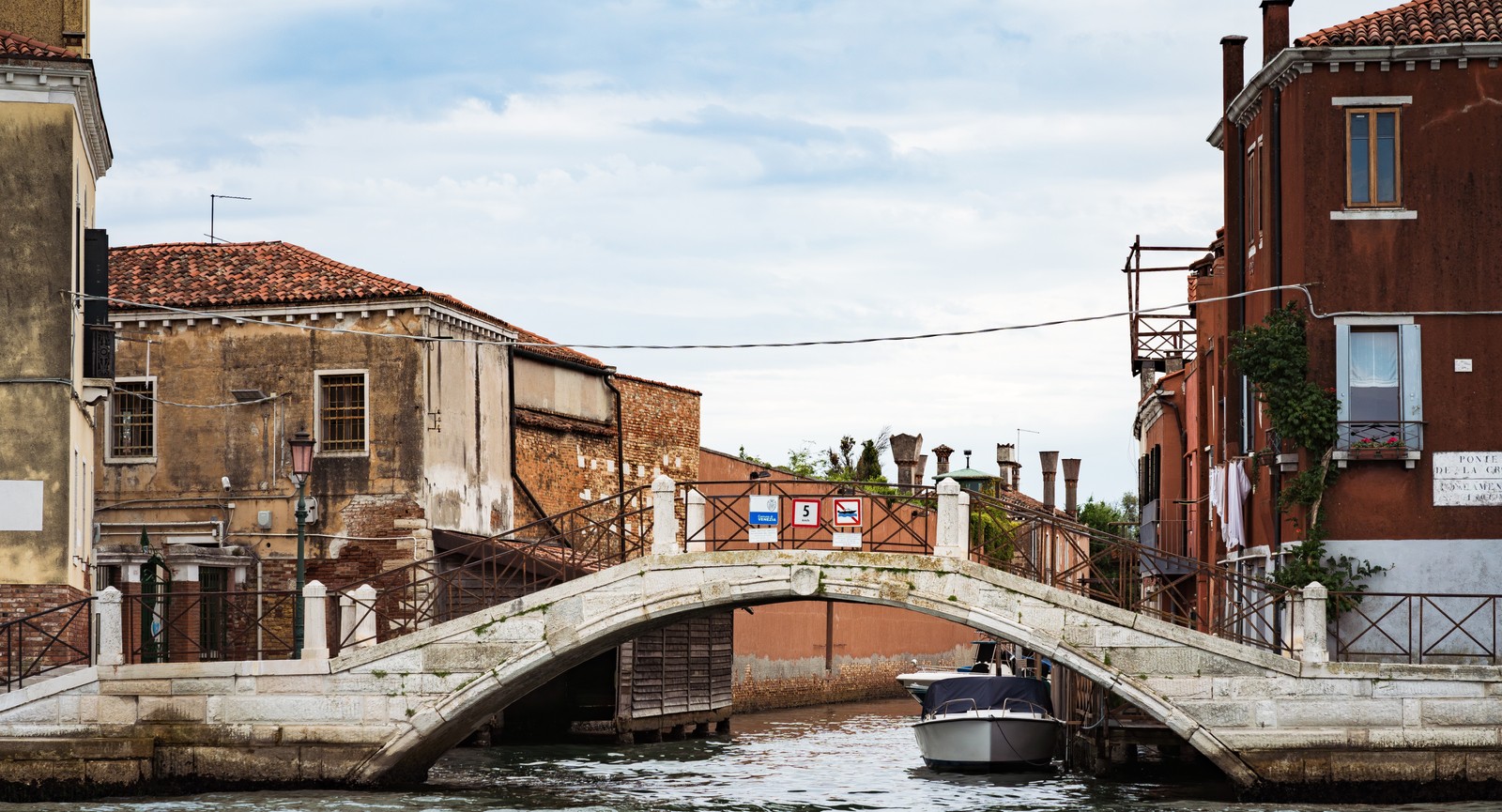
Maps lie: 10 famous cities that love to trick tourists
6 min.
Read Now
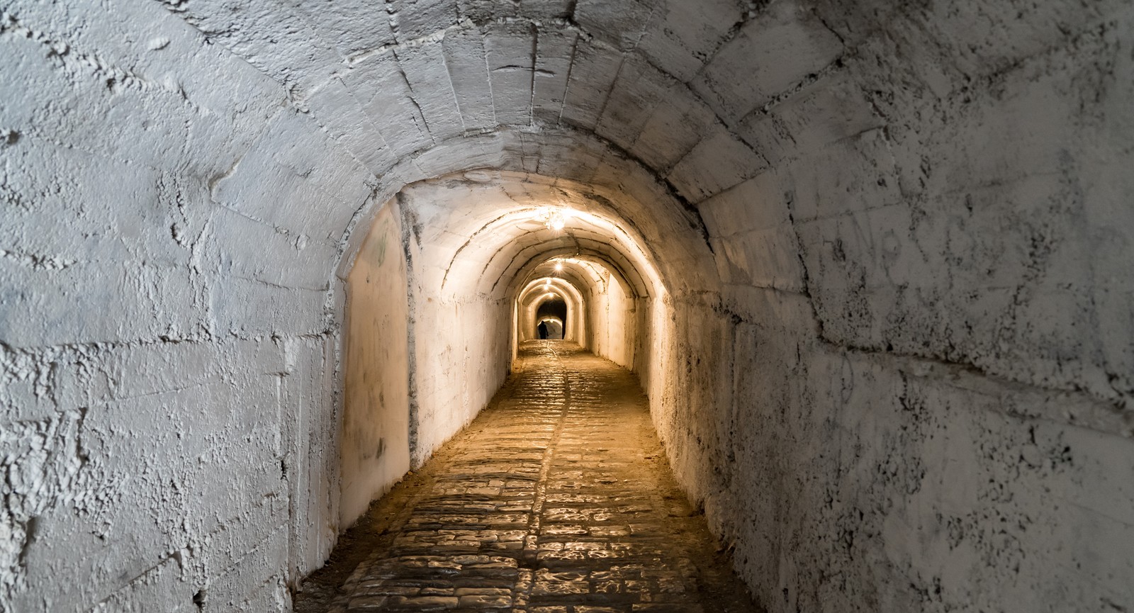
The whole town moved underground, and other stories that cities hide
6 min.
Read Now