Have you ever seen rocks shaped like this? Unique landscapes of the world
 Geography
Decoding mysterious shapes
Have you ever seen rocks shaped like this? Unique landscapes of the world
A beach with piles of shiny, giant marbles. A desert floor where rocks seem to move on their own. A lake that traps frozen bubbles under its surface. In this collection, we’ll travel all around the globe, stopping at landscapes so odd and unusual that you'll want to hear their stories and marvel at them.
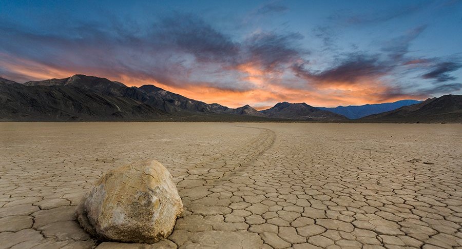
Racetrack Playa, Death Valley, California
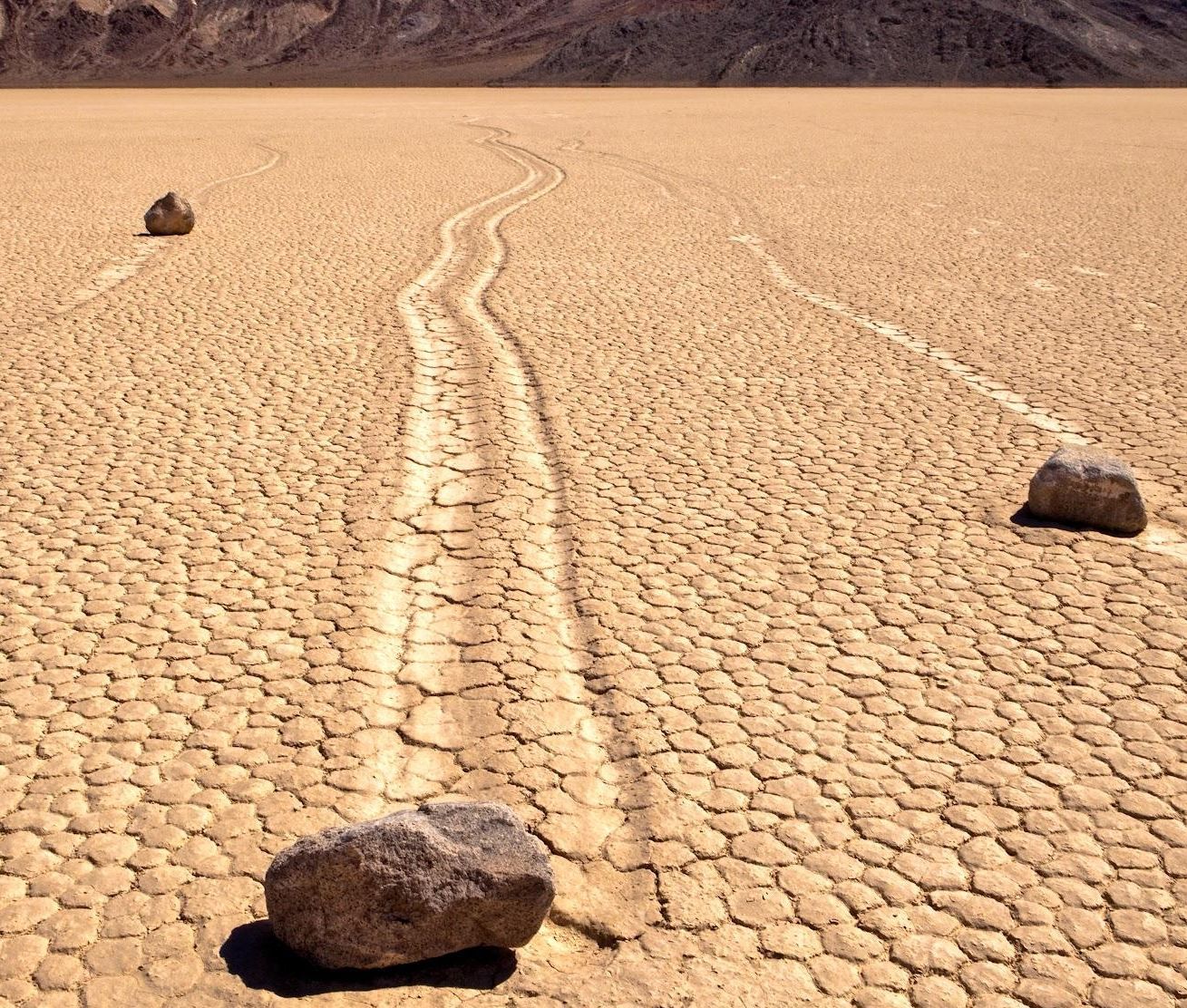
In a remote corner of Death Valley National Park, in California, US, lies one of geology’s most puzzling sights: rocks that appear to move on their own, leaving trackmarks on a dry, cracked clay lakebed.
This flat expanse is etched with trails of rocks that have slid across the ground, some weighing up to 700 pounds. The mystery was finally solved in 2014. As scientists explained, ice forms overnight in the area, forming a thin sheet; as the morning sun melts it, it becomes slippery, which helps the wind gently push the rocks forward just a few inches per second every day.
Spotted Lake, British Columbia, Canada
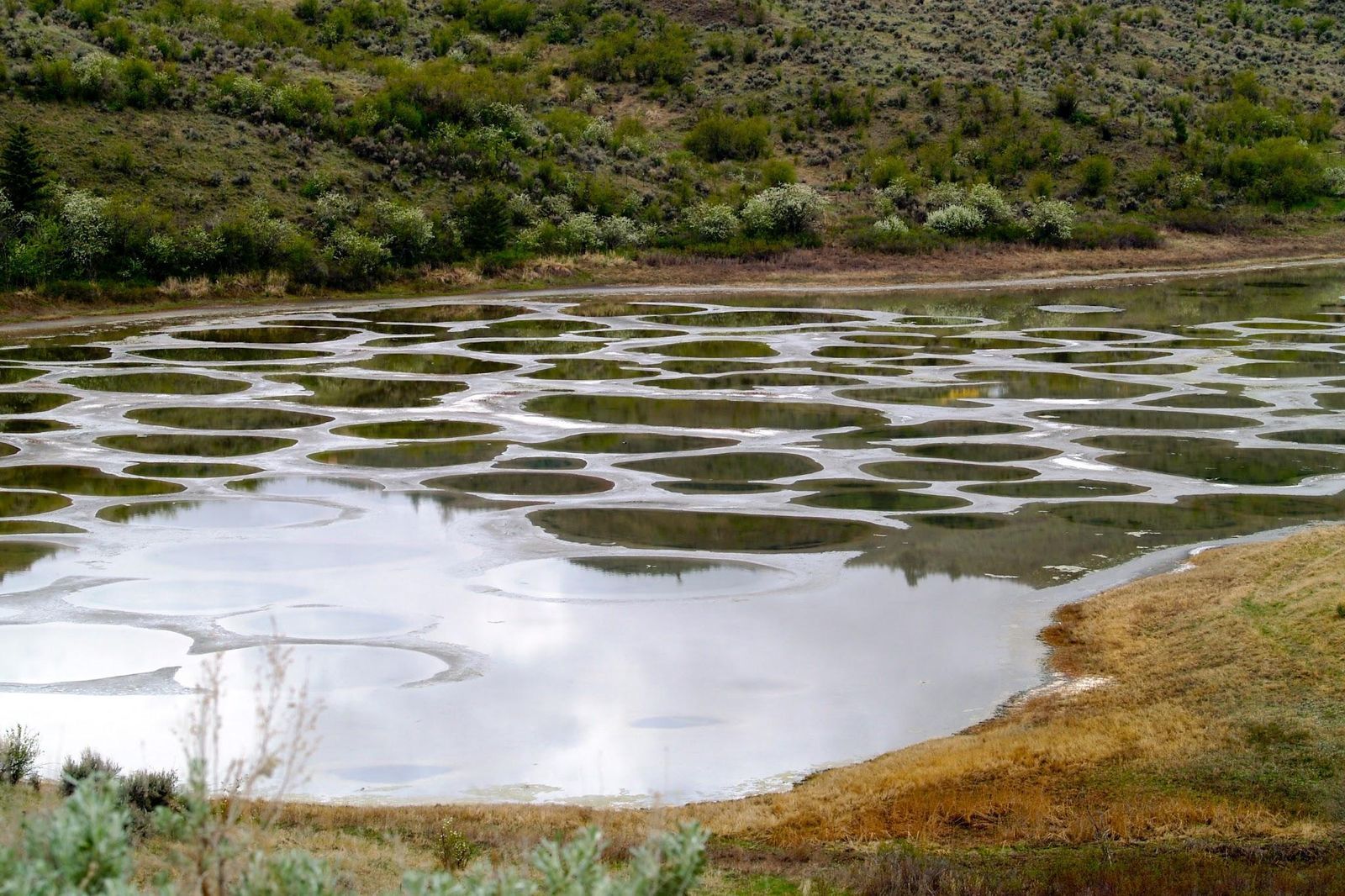
This small lake in the Okanagan Valley transforms each summer. As temperatures rise, the evaporating water reveals hundreds of "spots" formed by high concentrations of minerals, like magnesium sulfate, calcium, and traces of silver and titanium.
Each mineral crystallizes in different shades, like white, green, yellow, and brown. The polka-dotted lake has been known for centuries, and the indigenous Syilx (Okanagan) people considered it sacred for its healing properties. It is one of the most mineralized lakes in the world.
Lake Abraham, Canada
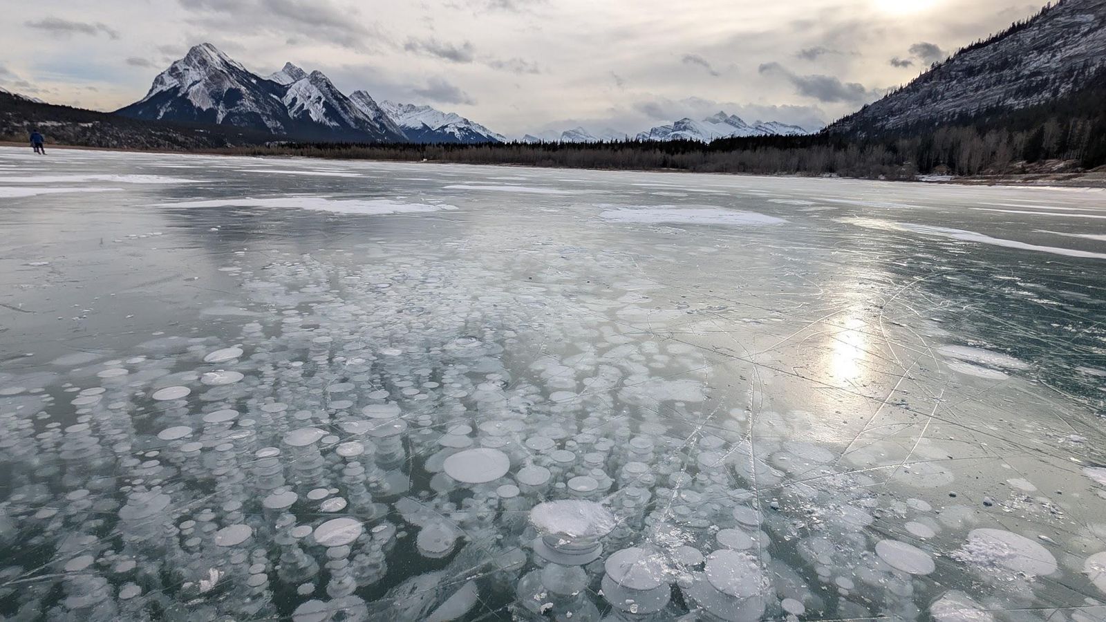
On certain winter days, visitors will be able to find a gallery of trapped bubbles that look like alien plants under the surface of Abraham Lake, in Alberta, Canada. This artificial reservoir was created in 1972 with the construction of the Bighorn Dam.
The striking phenomenon of the white bubbles is due to methane gas released by decaying organic matter on the lakebed. The gas becomes trapped under layers of ice as temperatures drop. Stunning, yes, but these methane bubbles would be flammable if released.
Giant’s Causeway, Northern Ireland
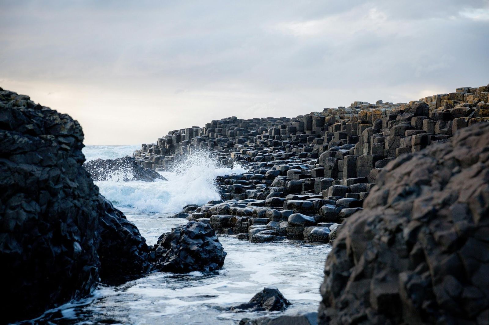
The stones of Giant’s Causeway form a landscape so geometric that it seems man-made. But it was nature that shaped it as it is. This is a UNESCO World Heritage Site featuring approximately 40,000 interlocking basalt columns that step down like stairs into the North Atlantic.
The formation dates back about 50 million years, when volcanic activity caused molten basalt to cool rapidly. As lava contracted, it fractured into the striking hexagonal shapes we can see today. The local folklore offers a more colorful explanation, though: the columns were built by the Irish giant Finn McCool as a bridge to Scotland, hence the name of the area.
Moeraki Boulders, New Zealand
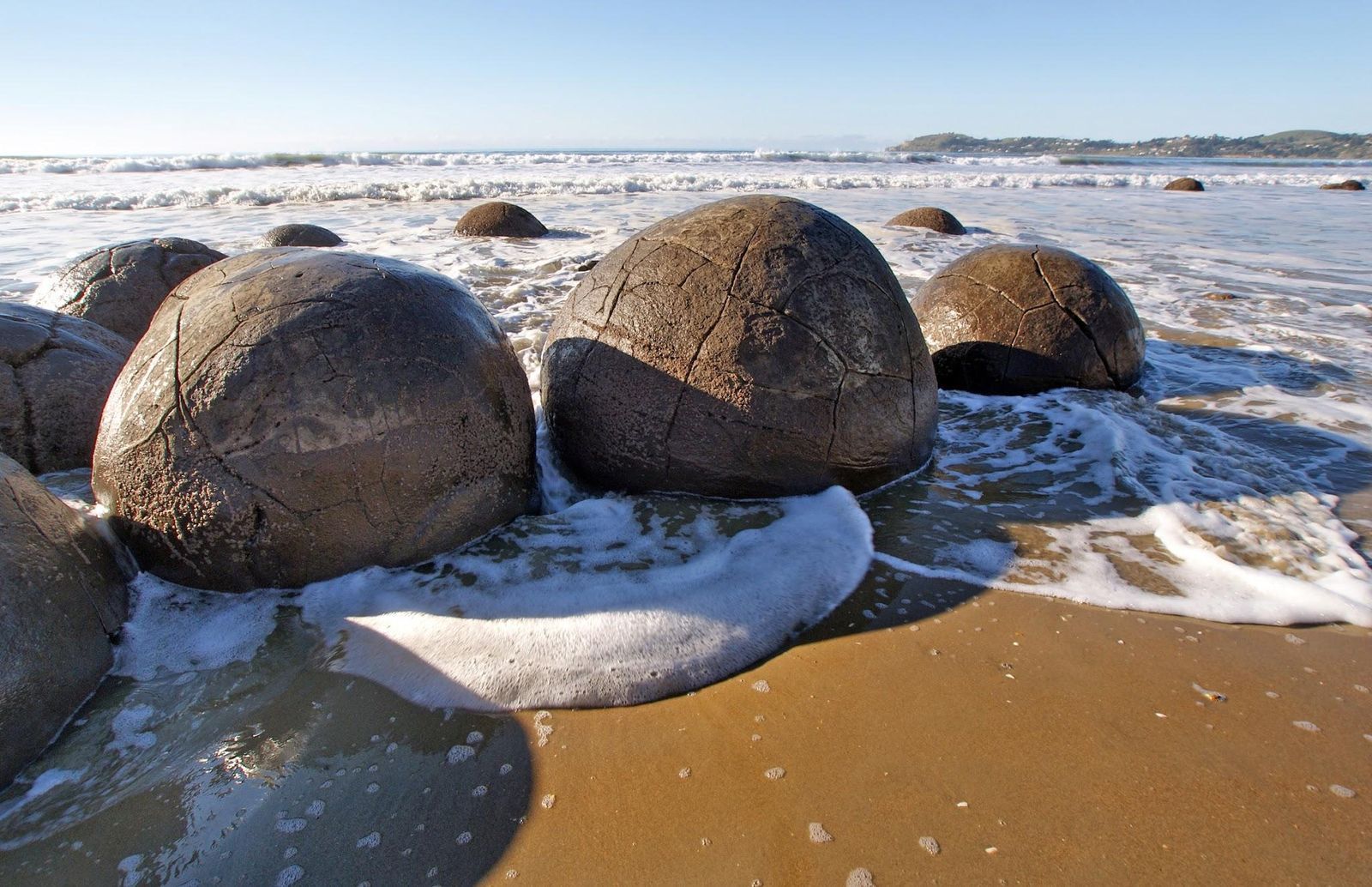
Scattered along Koekohe Beach on New Zealand’s South Island, these boulders look almost too perfect to be natural. They are massive, nearly spherical rocks, some measuring 7 feet in diameter.
Geologists now know that the boulders formed around 60 million years ago during the Paleocene period. They began as small mineral accumulations within marine sediment, which gradually grew as minerals crystallized around a central core. Some of them have cracked open, revealing their interior of intricate patterns filled with calcite crystals.
Mount Roraima in the clouds, South America (3 countries)
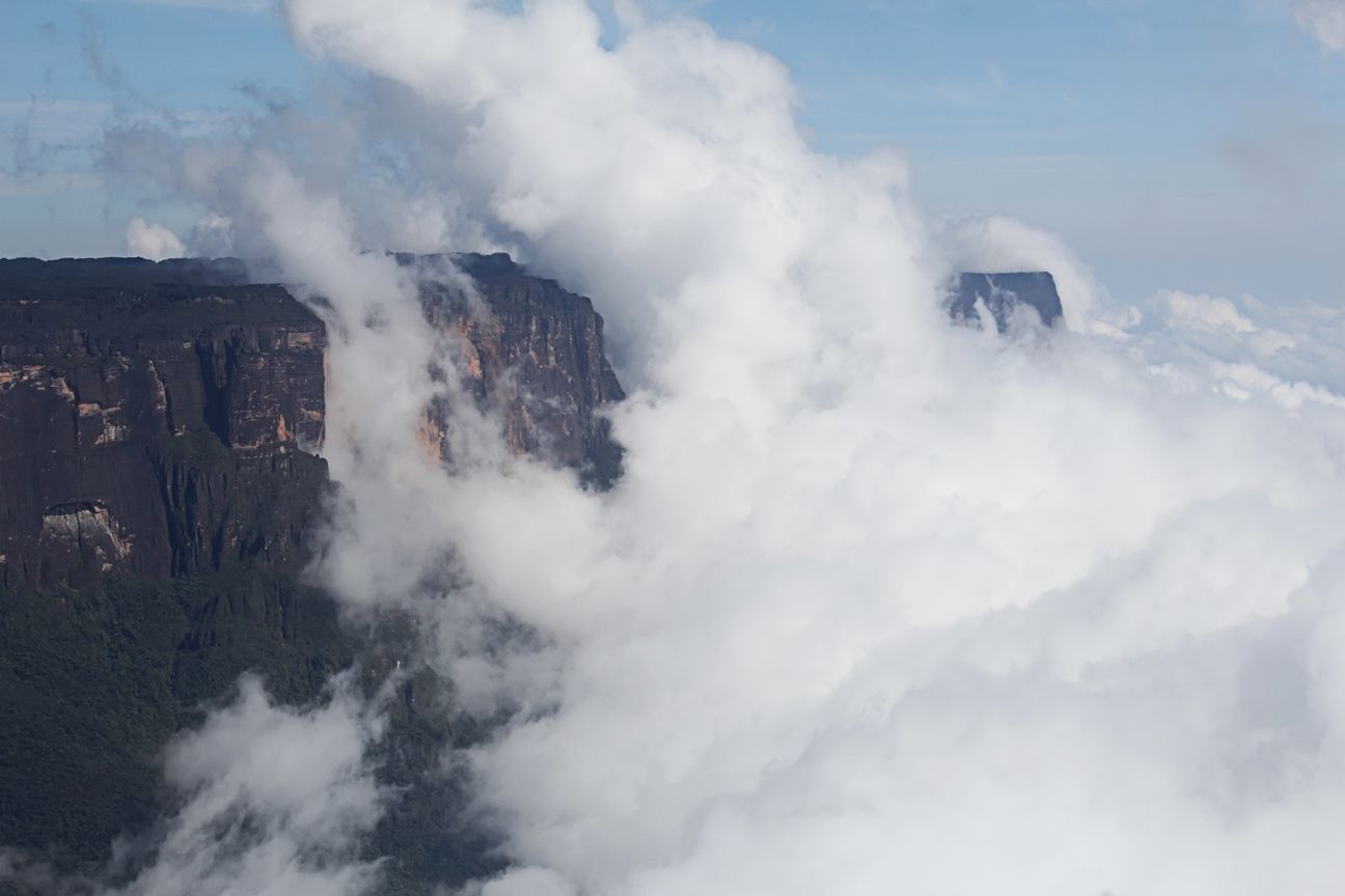
Sometimes, thick clouds will completely engulf the top of Mount Roraima, which sits in the frontier point between Venezuela, Brazil, and Guyana, in South America. Its flat top spans 12 square miles at an elevation of 9220 feet. That’s high enough for it to reach the clouds, becoming a mythical, eerie presence.
The isolation that Mount Roraima exists in has created a unique ecosystem, with plant species found nowhere else, including carnivorous plants adapted to nutrient-poor soils.
Diquís Stone Spheres, Costa Rica
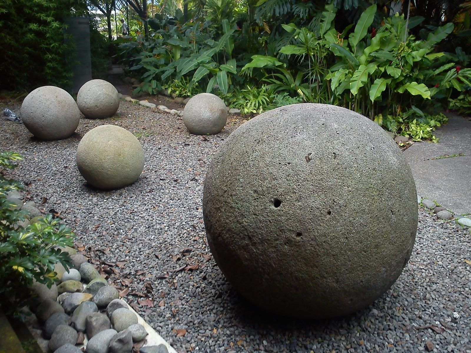
Contrary to those found in New Zealand, these giant rocks were not shaped by the forces of nature. They were very deliberately carved from a hard igneous rock called granodiorite by pre-Columbian societies, roughly between 300 and 1500 CE. Researchers haven’t been able to figure out their purpose, but they can agree that they were shaped using stone tools, heat, and abrasion techniques.
What’s shocking about them is their impeccable roundness and smoothness. They can be found in southern Costa Rica, at the Diquís Delta, scattered across the land. To date, more than 300 spheres have been recorded, some measuring a few inches, some over 6.5 feet.
Bent trees of Slope Point, New Zealand
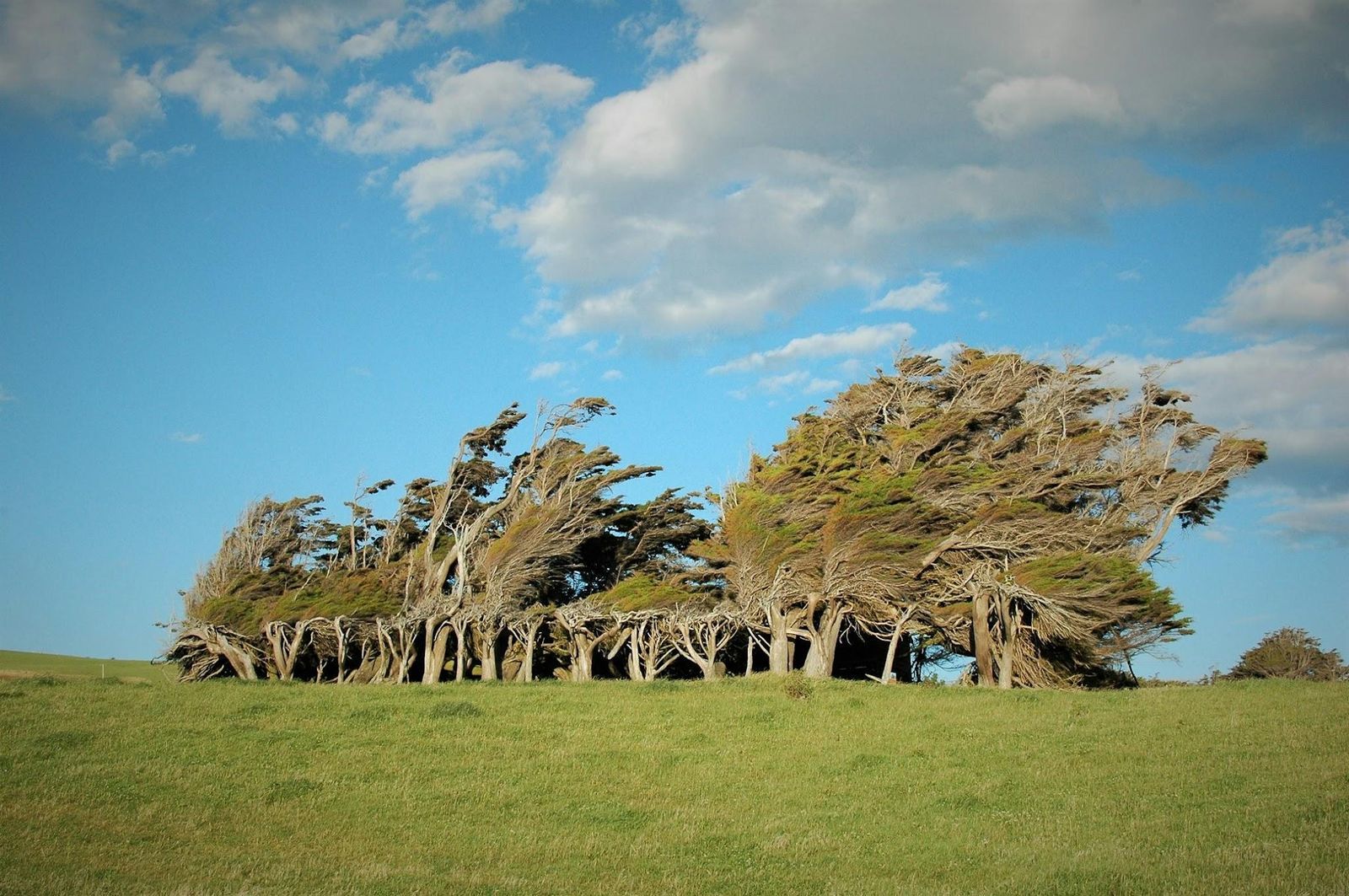
In this picture, it might appear that a strong wind is bending the trees sideways. But that is what the trees of Slope Point, New Zealand, look like on a regular day. This southern, remote coastal spot faces the full force of the winds sweeping up from Antarctica, exceeding 60 miles per hour. The result is a remarkable sculpture garden, and trees permanently twisted.
Great Blue Hole, Belize
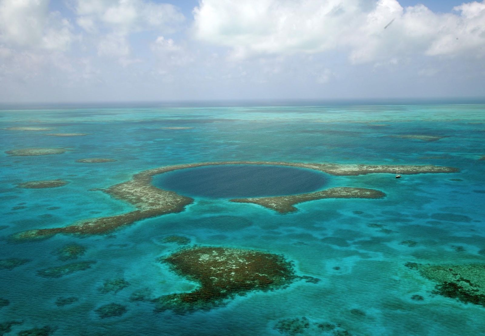
Off the coast of Central America, near the heart of the Belize Barrier Reef, lies one of the ocean’s most striking natural formations: the Great Blue Hole. This nearly perfect circular sinkhole measures about 1,043 feet across and plunges roughly 400 feet deep. It formed during the last Ice Age, when the area was a limestone cave system.
Beneath its deep blue surface, divers encounter stalactites—clear evidence of its dry past—along with reef sharks and other marine life. The site gained international fame in 1971 when French explorer Jacques Cousteau declared it one of the world’s top diving spots.
Fairy Circles, Namibia
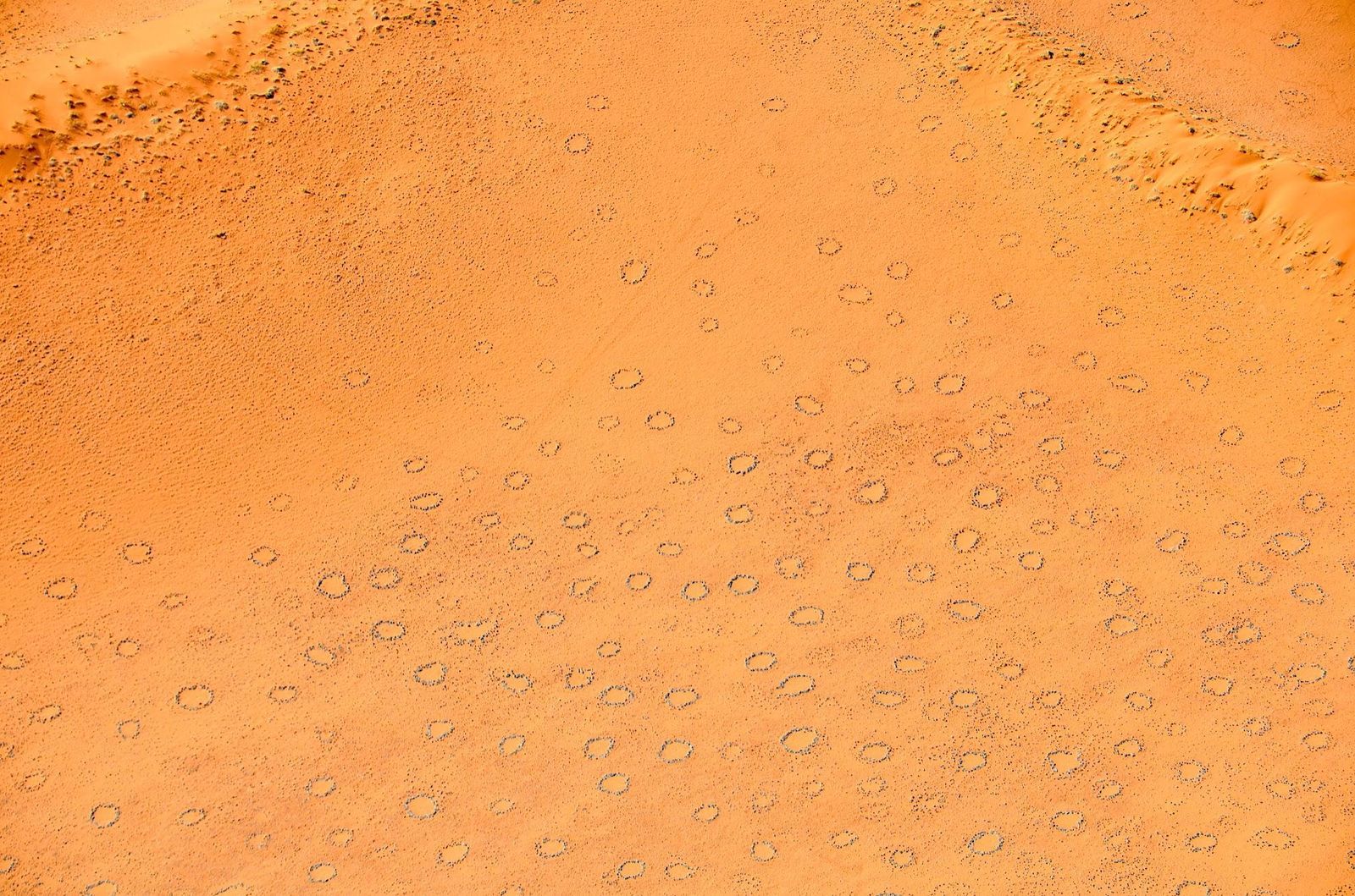
They may look like spots on an animal’s fur, but these Fairy Circles are nearly perfect shapes that range from 6.5 to 65 feet in diameter. They sometimes appear in vast, evenly spaced fields that extend for hundreds of miles.
They stretch across the arid grasslands of the Namib Desert, and their origin has sparked intense debate for decades. Are they remnants of cleared vegetation? Underground gases? Traces left by toxic plants? Research from the 2020s suggests that it results from termite activity interacting with the behavior of grasses competing for scarce resources. Of course, older folklore suggests other explanations, like spirits or dragons beneath the earth.
Symphony of Stones, Armenia
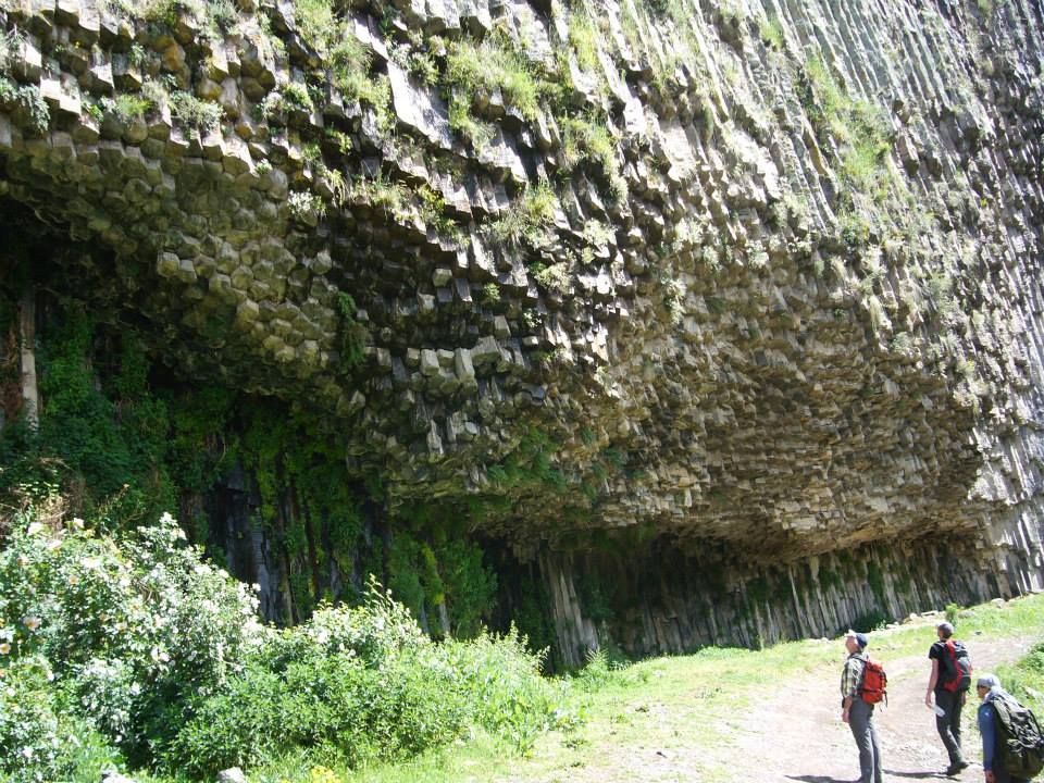
In a narrow gorge carved by the Azat River, the Symphony of Stones rises as one of Armenia’s most striking landscapes. This cliff face is composed of towering basalt columns that resemble the pipes of a giant organ.
The formation reaches up to 160 feet, with thousands of hexagonal columns tightly packed together. They formed millions of years ago through cooled molten lava contracting and cracking, a process known as columnar jointing.
Keep wandering
There’s always
more to explore
 General
These American locations demand your full offline attention
5 min.
Read Now

Always check this at an ATM: Safety tips for seasoned travelers
5 min.
Read Now

Bizarre laws you didn’t know exist in U.S. tourist spots
4 min.
Read Now

Which countries drive on the left side of the road?
5 min.
Read Now